First of all, a bit of background: to get onto the Mountain Leader course, I have to complete and log twenty ‘quality mountain days‘. It’s been winter, so my last couple of QMDs were back in October. However, now spring has sprung, I’m off back up mountains.
My previous four QMDs were in the Lake District, but this time I thought I’d mix it up a little by heading to Scotland. This is a little further for me to drive from my home in Northumberland, but, as you’ll see, it was definitely worth it!
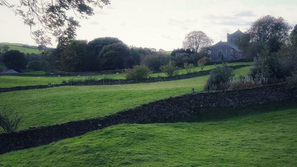
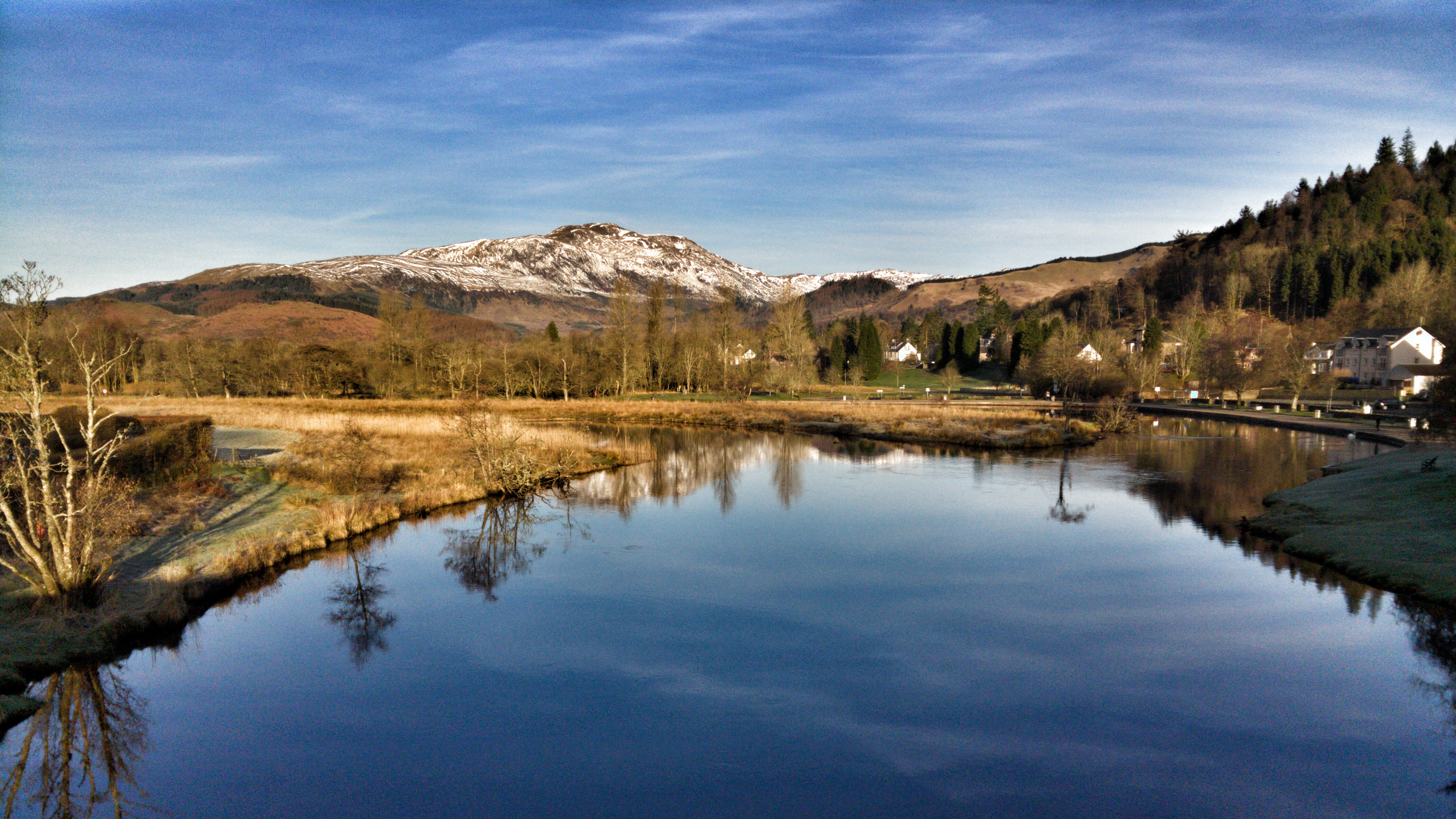
Given that it’s only March, I decided against the Cairngorms, leaving that area for the summer months. Instead, I focused on Loch Lomond & The Trossachs National Park.
The great thing about the Ordnance Survey’s OS Maps app is that you can see routes that other people have added, and use these as inspiration for your own. I decided to go up Ben Ledi on Friday, and Ben Vorlich on Saturday, staying over at Callander Hostel.
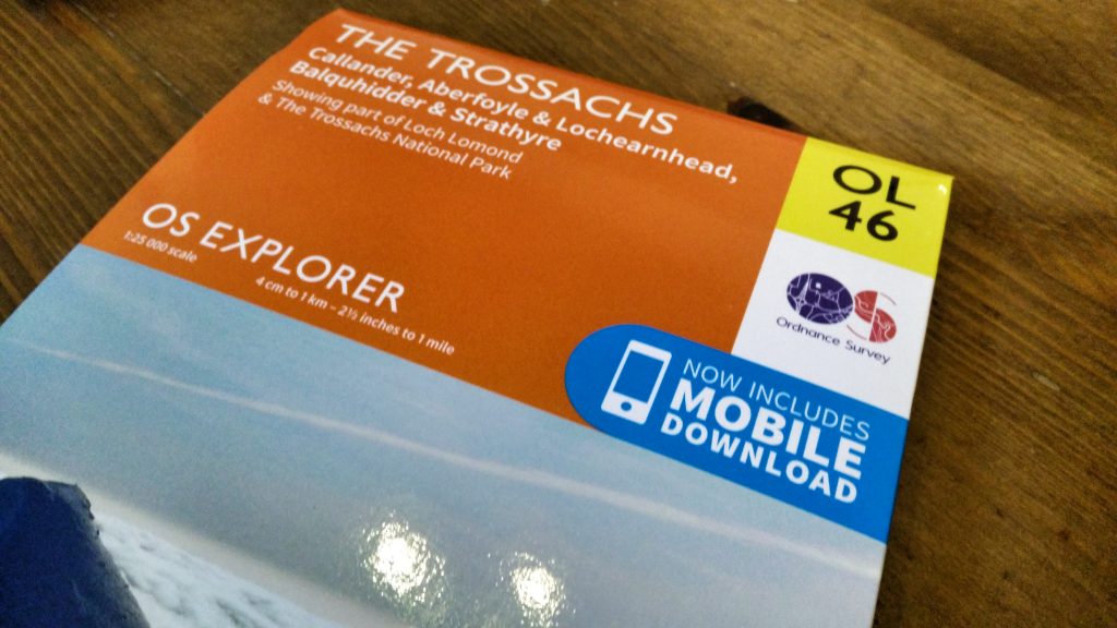
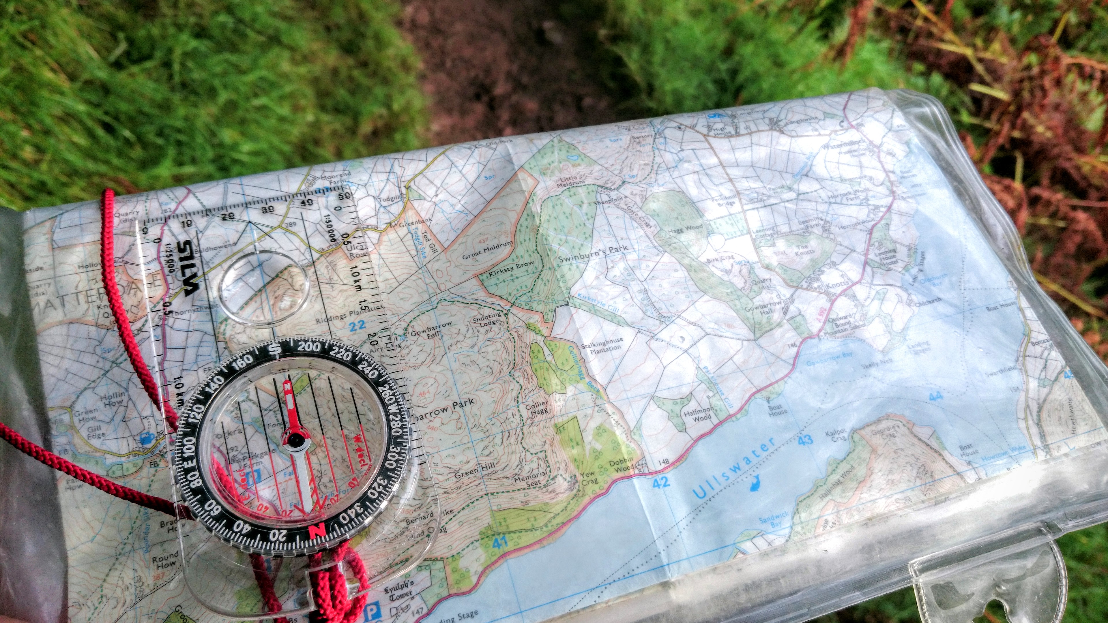
Before I left, I watched some videos from The Bushcraft Padawan, aka Craig Taylor, who I know from the world of edtech. As you can see from the photos of my map further down this post, I followed his suggestions to pimp my map. I checked the Mountain Weather Information Service, which promised optimal conditions!
I knew I’d be tired on Saturday, as I never sleep that well when I’m away from home (especially in hostels where you can guarantee someone will snore) and I’d have spent a full day walking on Friday. It was for that reason, that I decided to walk further on Friday than on Saturday.
Friday (QMD 5)
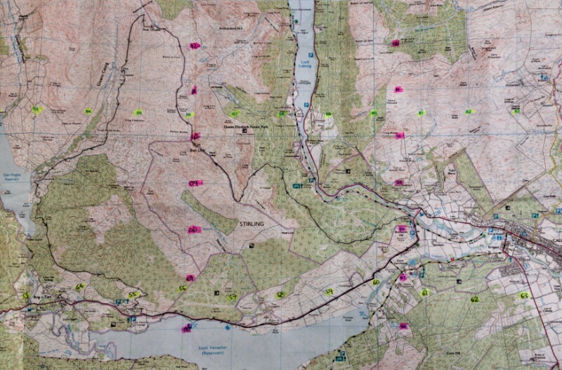
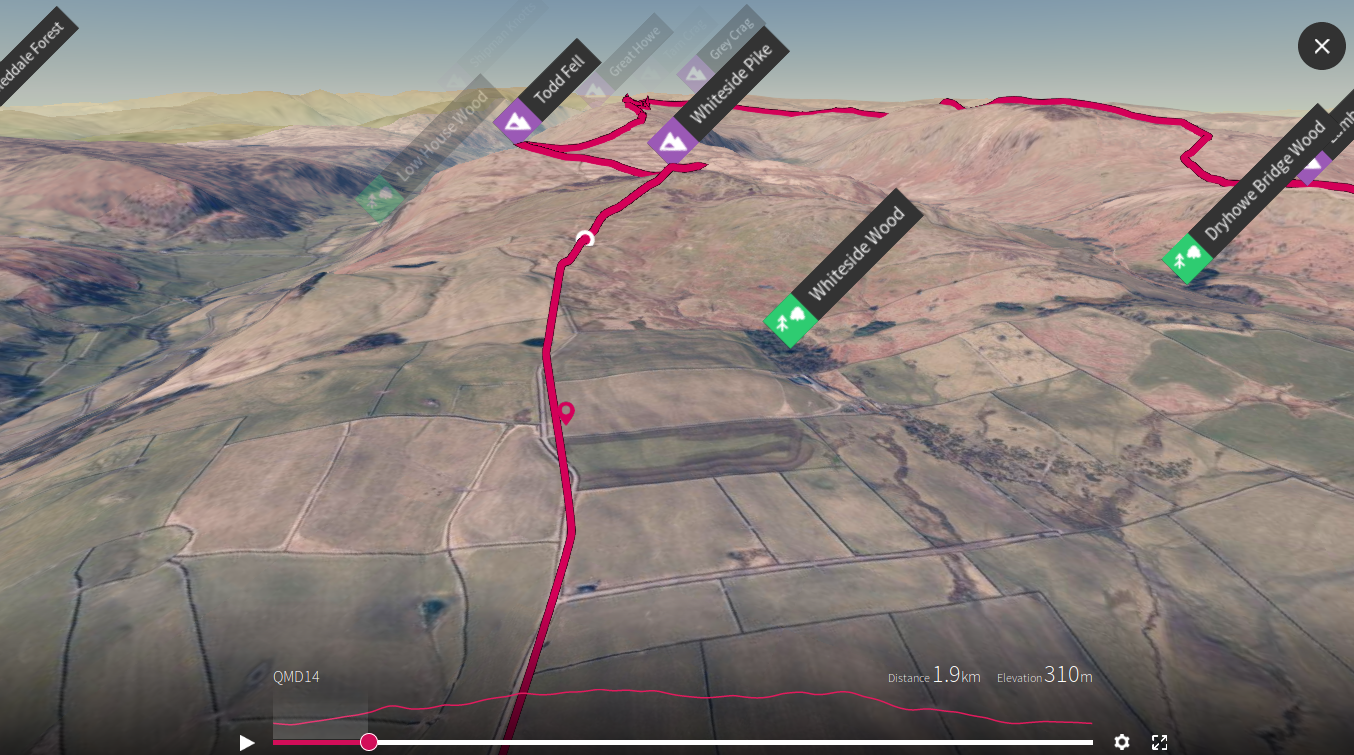
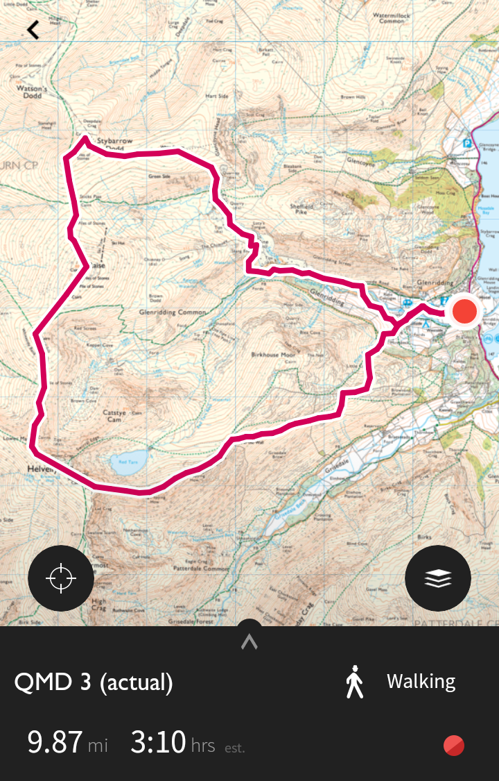
The route I planned at home went up Ben Ledi, across to Stuc Dhubh, down the trail, through the trees and round past a waterfall, and then along the road back to Callander:
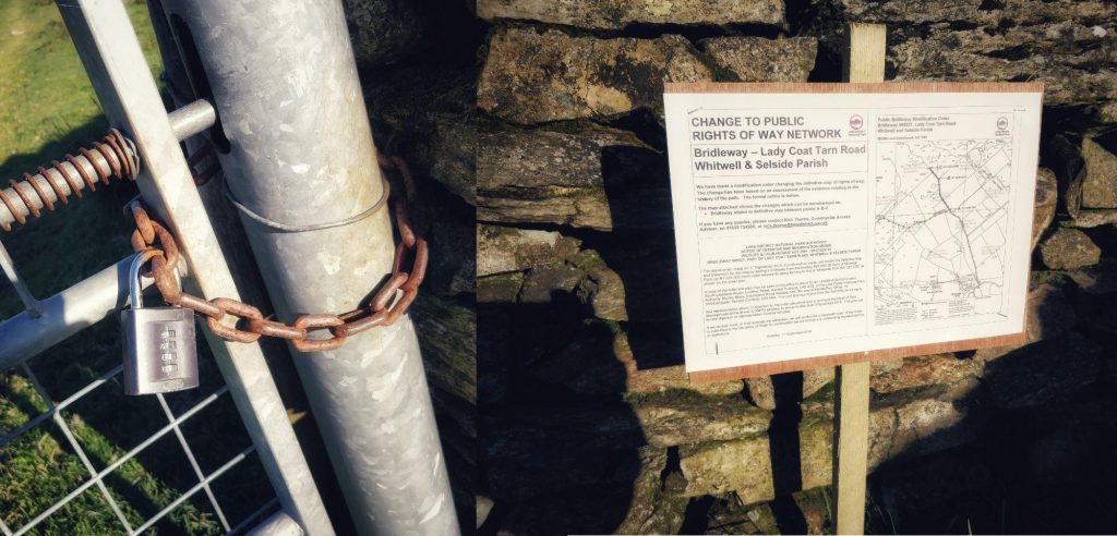
Driving from my home to Callander took a little over three hours. It was a straightforward journey, with light traffic and wonderful views. On arrival in Callander, I found the hostel, parked my car, and tried to find someone to give them a route card. However, there was no-one to be found, so I sent the route to my wife and told her to call Mountain Rescue if she hadn’t heard from me by 19:00.
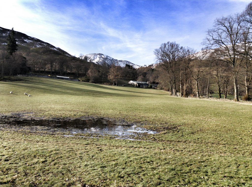
Instead of driving from the hostel to the start point I’d originally identified, I walked to it, which added a good half an hour to the overall journey time. The initial walk up the path was pleasant.
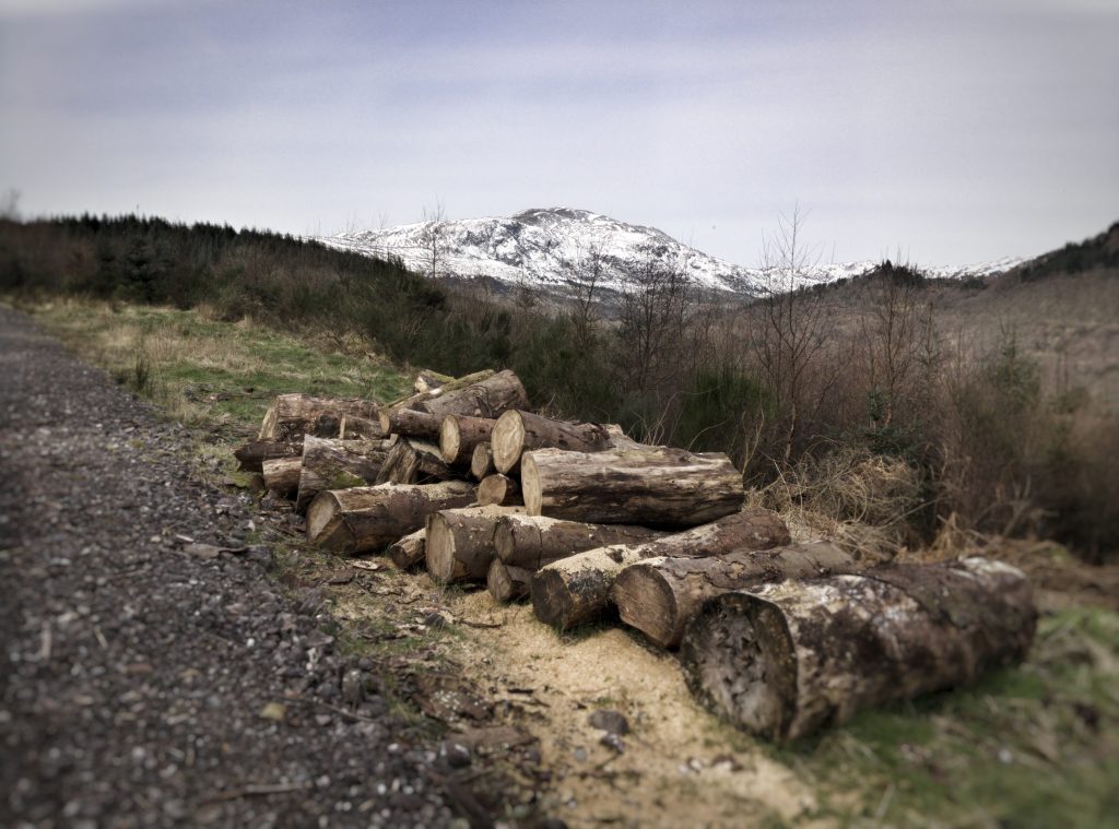
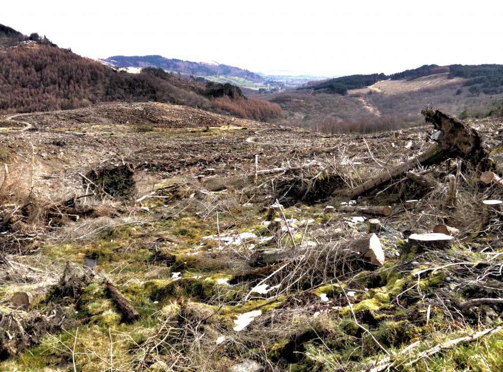
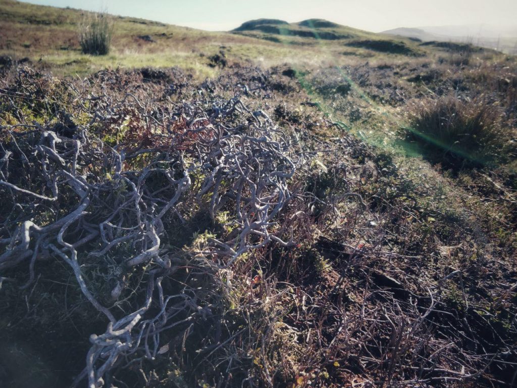
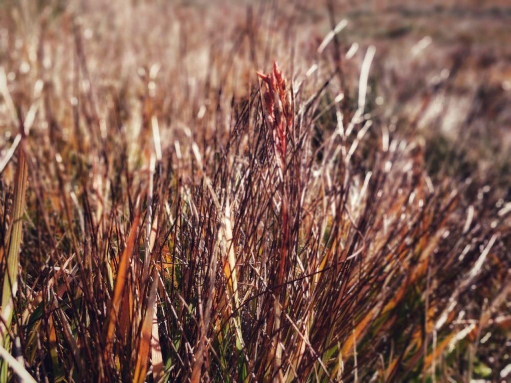
However, I soon got to a scene of devastation. The timber forest around Ben Levi is a ‘crop’ and as such is harvested. What is left, though, looks like what I imagine parts of England looked like after the Harrying of the North.
I sat down on a few logs and sent my wife the image below. I put down my hat, gloves, and sunglasses. When I got back up, I must have knocked them off onto the ground somehow, as I realised about an hour later that I didn’t have them.
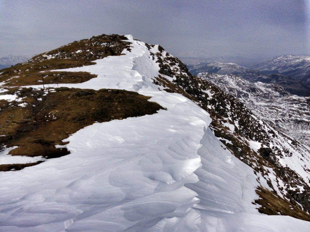
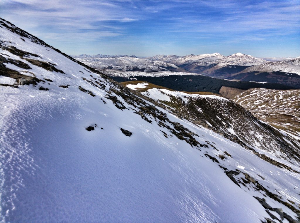
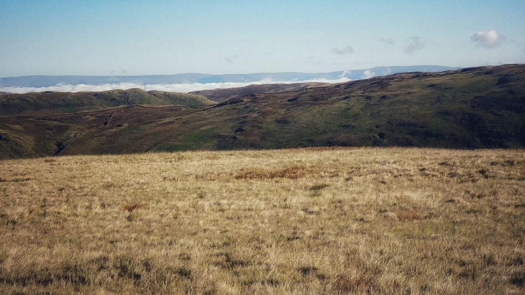
The route up to the top of Ben Ledi from that point involved some steep sections, but it was the snow that surprised me. I hadn’t expected it to be so deep!
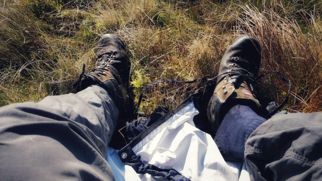
Just before I made the final ascent to the top of the mountain, I sheltered from the wind behind a rocky outcrop. My hands were dirty, so I rubbed some alcohol gel into them in preparation for eating my lunch. That decision ranks as one of the stupidest I’ve made while on the side of a mountain, as without gloves, the wind on my hands then made them feel extremely stiff. I ended up putting spare woolly socks over my hands.
Once I got to the top of Ben Ledi, I followed a trail on my map rather than a demarcated path. The snow got even deeper at this point, to the extent that I had to start being very careful about the route I was taking.
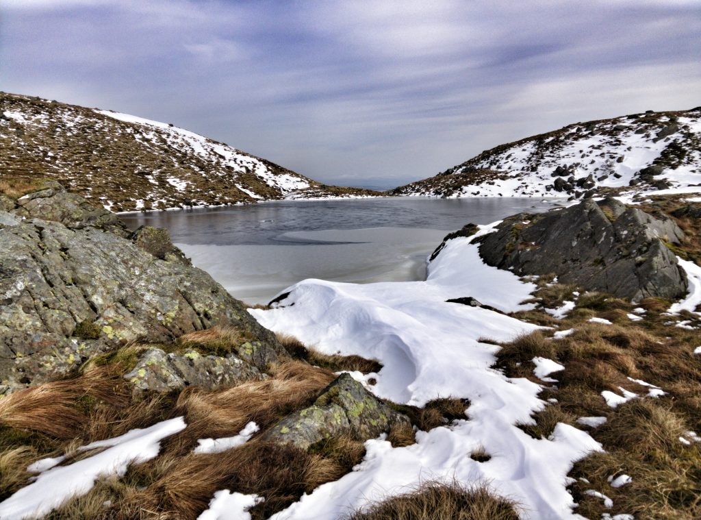
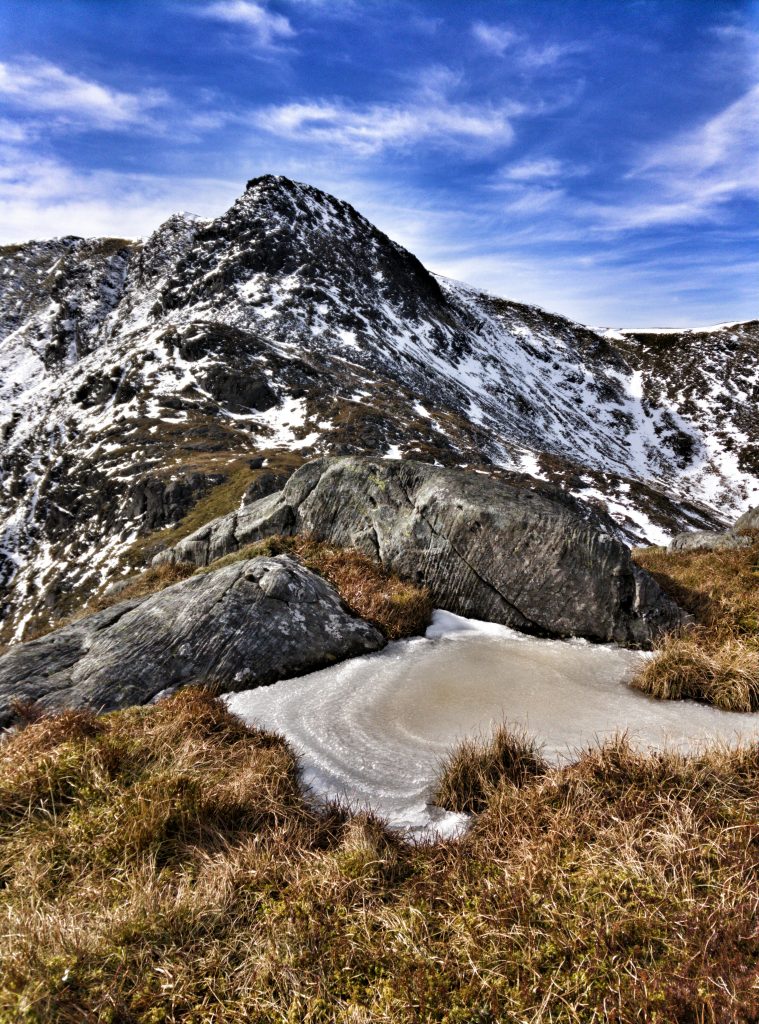
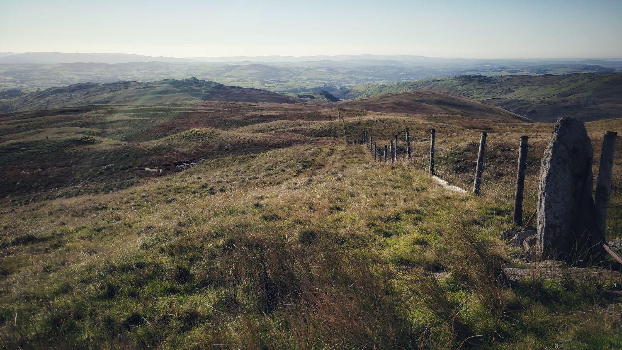
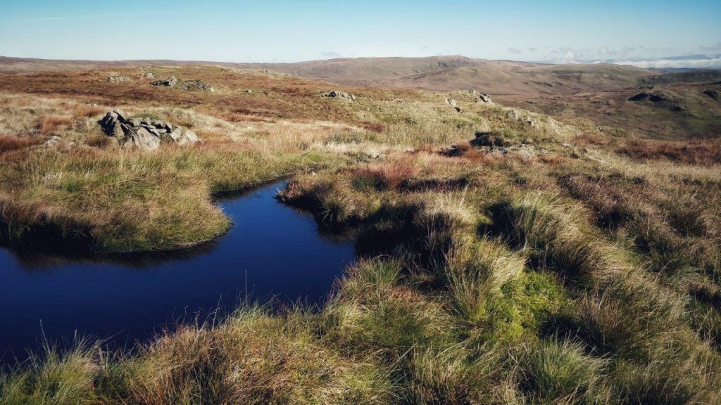
My route took me via a couple of tarns, which were partly iced over and beautiful to behold. I just stopped and looked for a couple of minutes, before the cold wind encouraged me to keep moving.
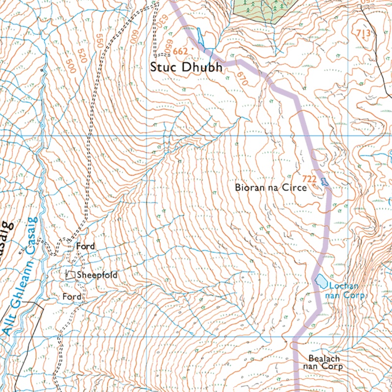
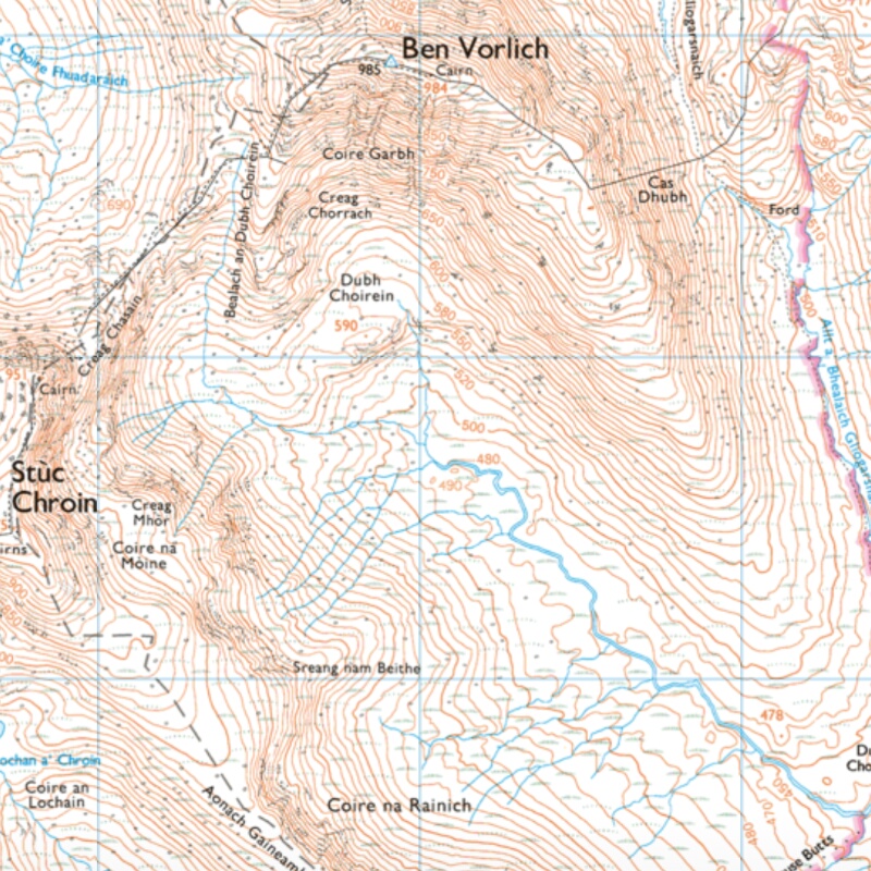
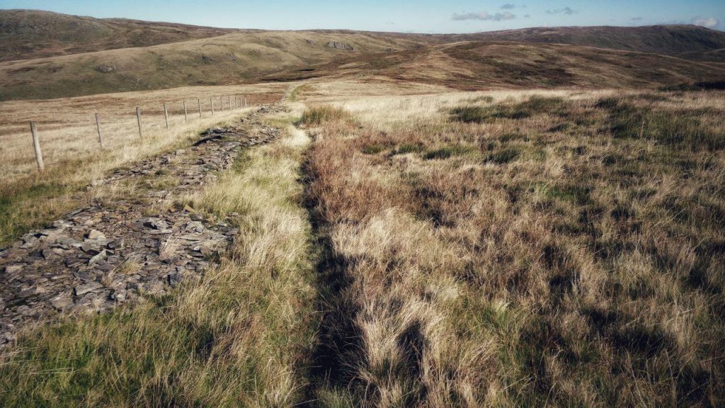
The purple line on the map below shows the edge of a boundary between areas looked after by different organisations. It’s also, however, a path. I’d intended to head up to Stuc Dhubh and then down the track to Allt Ghleann Casaig.
However, by the time I got to the top of Bioran na Circe, the snow was thigh-deep, so I made my way down the slope towards the two fords. To make this easier, I kept the stream to my left, and the gully to my right.
It wasn’t easy going, and I slipped and slid down. I was thankful to get to the bottom. From this point onwards, I was walking along tracks and roads back to the youth hostel. It took me what seemed like ages to get back, and by the time I was on the last stretch, I had my head torch on. I’d already contacted my wife by that point, but I got back just before 19:00.
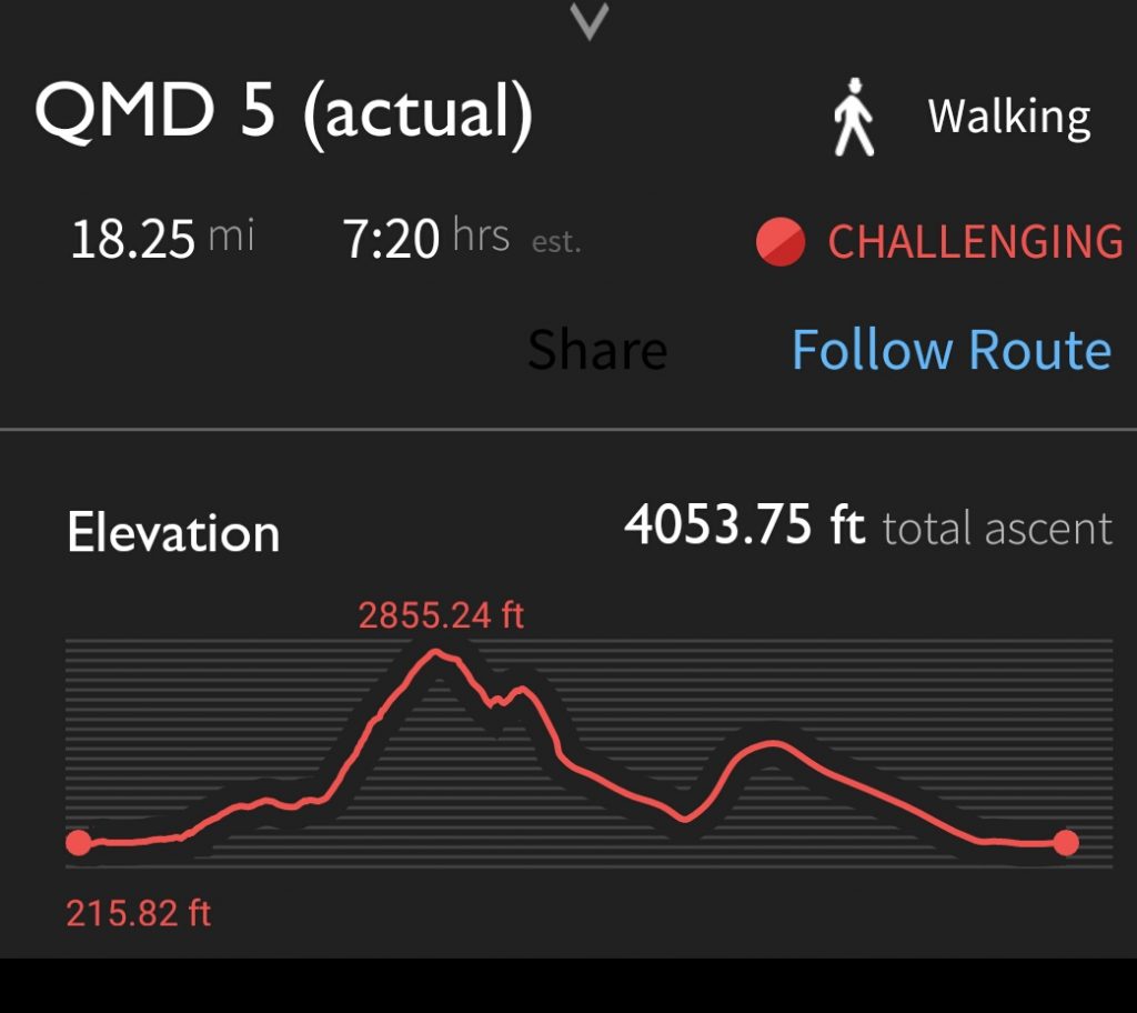
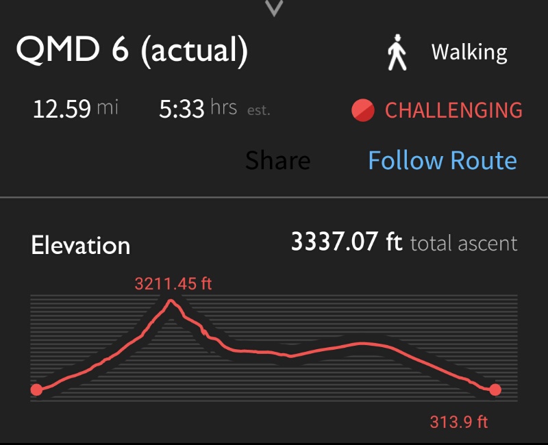
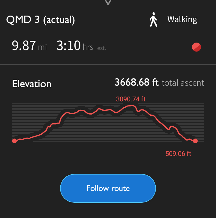
As you can see from the above, I use the OS Maps app to track my route. I was out for over seven hours, walked over 18 miles, and ascended over 4000 feet. I was pretty tired by the time I checked into my hostel, staggering out after a warm shower to get some fish and chips.
I slept reasonably well, despite the inevitable snorer, and the two drunken idiots who burst in at 02:30.
Things I learned
- Check you’ve got everything once setting off again after resting.
- Don’t put alcohol gel on your hands in cold weather.
- Plan interesting routes that don’t involve lots of walking on roads.
Saturday (QMD 6)
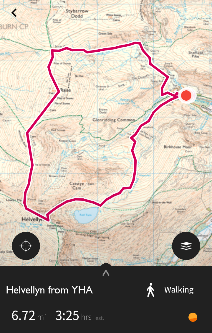
The route I planned at home took a straight route from the southern shore of Loch Earn up the path to Ben Vorlich. From there, it looked like a straightforward walk to Stùc a’ Chroin, along the ridge, round and up along the river back to my starting point:
I was anticipating a couple of things on Saturday. First, because it was the weekend and a beautiful sunny day, I knew that there would be plenty of people out and about. Second, from the map, I anticipated an easier day than Friday. I was wrong on both counts; there were about the same number of walkers, and it was much harder going than Friday.
I bought provisions in Callander, and then drove around to my starting point. I hadn’t needed my ‘proper’ camera or my waterproofs the day before, so I left them in the car to make my backpack lighter.
My optician had warned me earlier in the week of the need to protect my eyes given my pale blue irises and ‘larger than average’ pupils. Having lost my walking sunglasses on Friday, I was forced to wear my aviator-style driving sunglasses. This was less than ideal.
It was tough-going up Ben Vorlich. Thankfully, I had a couple of individual walkers ahead of me, meaning that the route through the snow was clear. The path was steep, and very slippery in places. It made me realise why people have walking poles.
I overtook a guy who had a couple of dogs with him, and felt I was doing well. However, life has a way of knocking you down a peg or two and, on this occasion, that was done in quick succession. First, I came over the brow of the hill to see the final ascent involved scrambling through ice and snow. Second, a guy in his early twenties ran past me. Unbelievable.
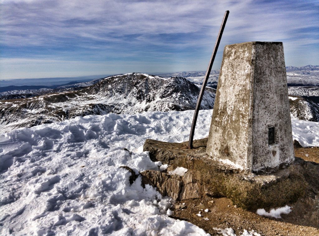
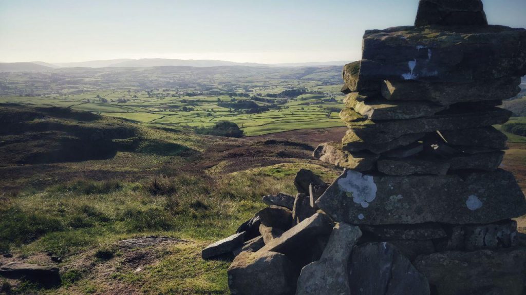
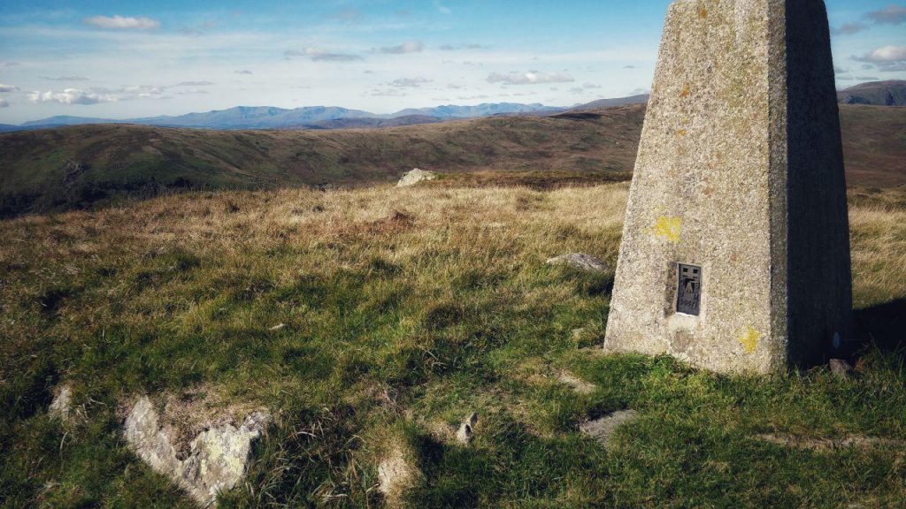
I did, however, finally get to the top of Ben Vorlich. It felt like an achievement, and the views were stunning. I stopped for a few minutes, and then pressed on towards Stùc a’ Chroin.
It didn’t take long for me to realise I hadn’t read my map very well when planning this route. What I had assumed was a ridge from Ben Vorlich to Stùc a’ Chroin actually involved a steep, snowy descent followed by an even steeper ascent. I sheltered at the bottom of the pass, enjoying my steak pie and bottle of Lucozade.
When I’m out on mountains, I talk to myself in my head. Not in a personality disorder kind of way, just in the sense that I think all of us do: having a conversation as to what’s coming up and what my response is going to be. Usually, I have no problem willing myself on after geeing myself a bit.
However, on this occasion, tired after yesterday’s walk, and surprised at having another steep ascent to make, I just couldn’t bring myself to do it. Instead, I decided to re-route and take what I assumed would be an easier route along the river.
Oh, how wrong I was.
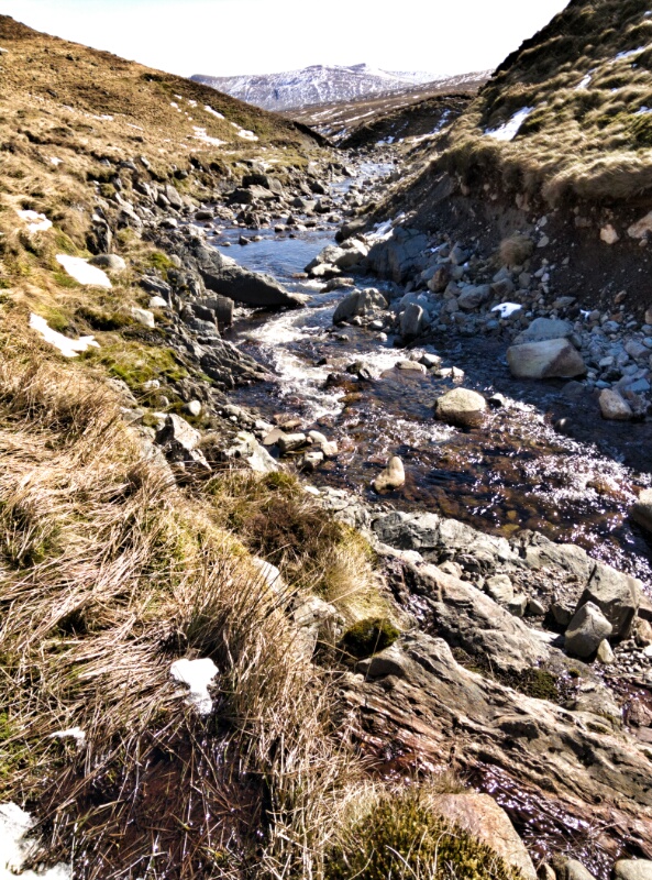
Not only was the way down tricky, but the ground all the way walking down, keeping the river on my right-hand side was extremely boggy. I saw a herd of deer at fairly close quarters, but wasn’t quick enough to take photos.
I struggled through snow on top of sucking mud for what must have only been two or three miles, before turning the corner. I was hoping, but again it was assumption rather than close map reading, that the trail back would be reasonably straightforward. I had only paid attention to elevation, rather than what the ground would be like underfoot.
The journey by the river, however, felt like a walk in the park compared to what came next: walking over snow-covered heather, with small stream underneath. It was really hard-going, and I had to keep an ear out for the tell-tale sound a small stream under the snow. On a couple of occasions, I put my foot down through the snow and heather into a stream.
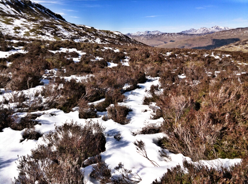
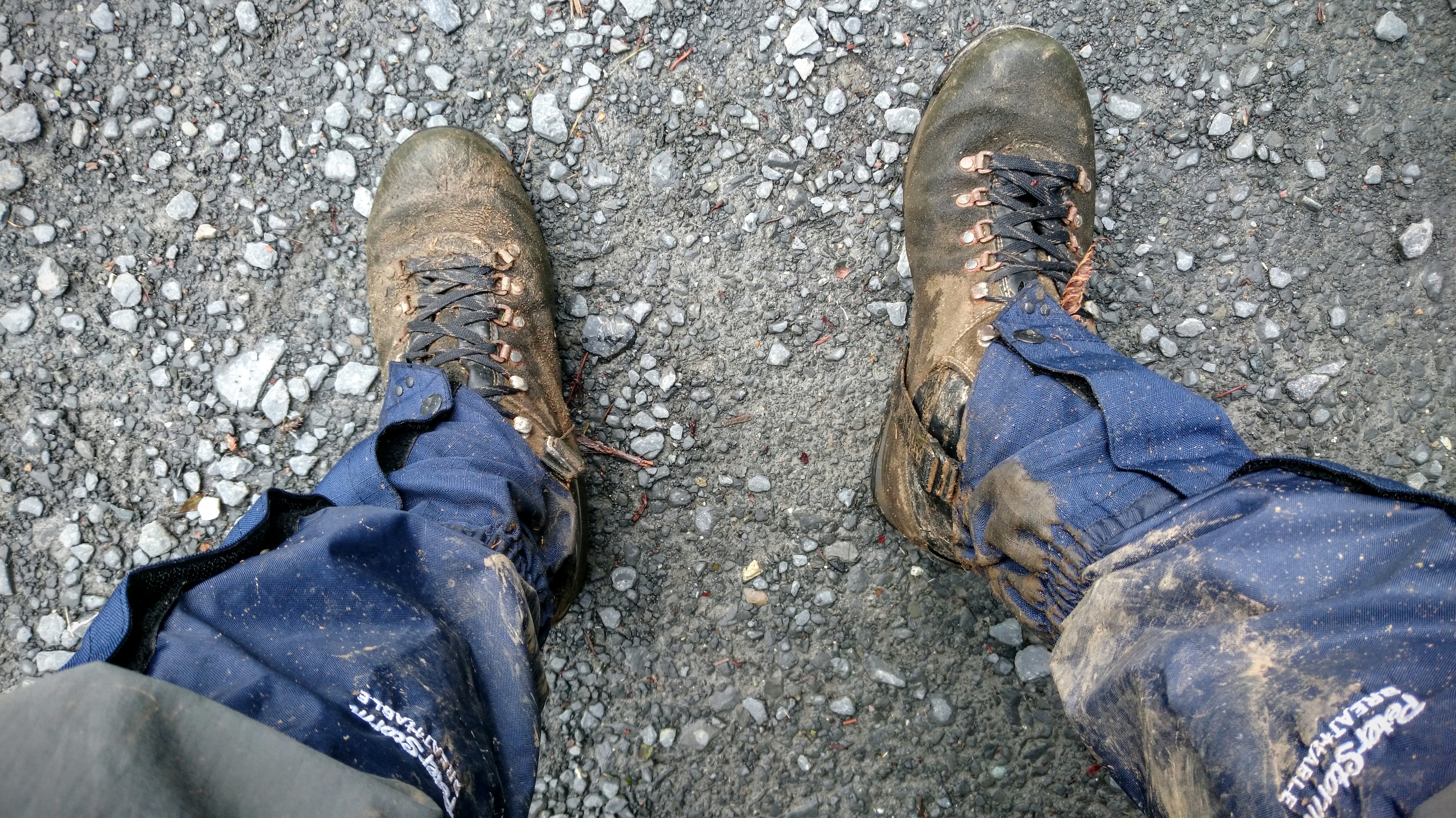
I was wet. I was tired. I was fed up. The photos all make it look beautiful, I suppose, but I had my head down most of the time, trying to not to stumble. The trail marked on the map was like Blackadder’s four-headed, man-eating haddock fish-beast of Aberdeen. It didn’t exist.
Eventually, I turned a corner and saw something so mundane, but so welcome: a bridge. If there’s a bridge, there’s a path. And from there, I walked down what felt like a motorway back down to my car. I collapsed into the boot, removing my sodden boots and gaiters, tore off a large piece of Soreen malt loaf, and greedily pushed it all into my mouth.
The above information really requires the context given above to understand the impact it had on me as a mountain walker. Despite a shorter route both in terms of length and duration, and the total ascent being less than Friday, nevertheless Saturday’s route was hard.
The drive back home was frustrating, both because of my desire to get home and drink all of the whisky in my house, but also due to the weekend traffic and number of speed cameras in the Scottish borders.
Things I learned
- Assume nothing. Check and double-check your route, especially when it comes to elevation and ground underfoot.
- Consider buying walking poles. It could save your knees.
- Mountain water tastes amazing.
Next week, I’m planning to head back up to Scotland for my seventh and eighth QMD. Can’t wait.
