The Pennine Way, Pt.1 (Kirk Yetholm to Middleton-in-Teesdale)
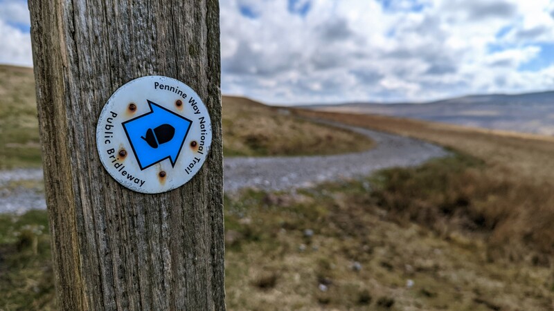
The Pennine Way may not be the longest of the UK’s National Trails, but it’s probably the best-known. It’s also seen as the toughest. The route is 268 miles (431km) long, with most people walking it from south to north — i.e. from Edale in Derbyshire, to Kirk Yetholm just over the border in Scotland.
For various reasons mainly related to logistics, I decided to walk half of it in April 2023 from north to south. I’ll walk the second half of it later, perhaps from south to north.
There are plenty of great blog posts out there about equipment, accommodation, and the like. This means I can spend time in this post introspecting and simply talking about my experiences. If you’re mainly interested in photos, look here.
Day 0: Kirk Yetholm to Hen Hole
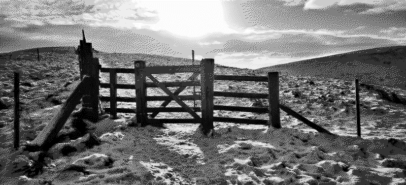
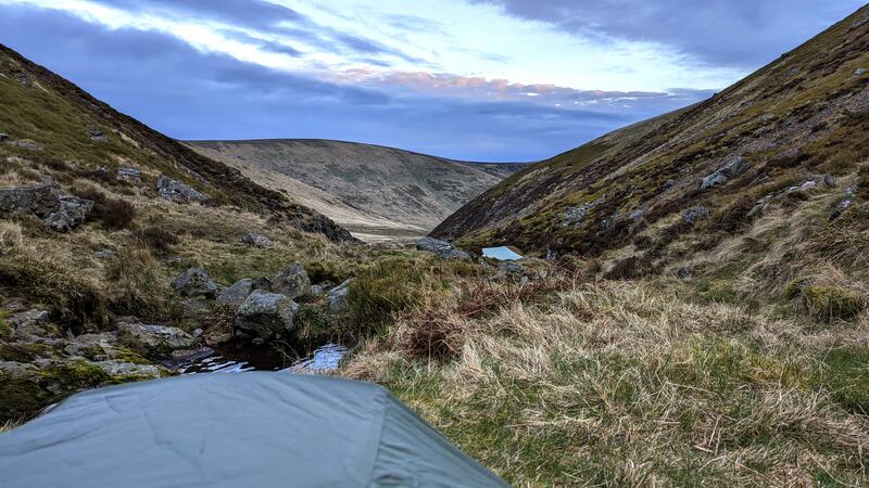
I live in Morpeth, which is only about an hour away from Kirk Yetholm. That means I know the area pretty well, including Hen Hole, the place I chose to wild camp on the first night. It’s a beautiful spot, and only around 10km away from the start/end of the trail.
On the morning before setting off, I got out my one-person tent, pitched it in the garden, and replaced some of the original tent pegs with some ultralight ones. Despite setting off wearing a t-shirt extolling the virtues of packing light, I opted for the 65-litre rucksack I bought for my Hadrian’s Wall trip last year.
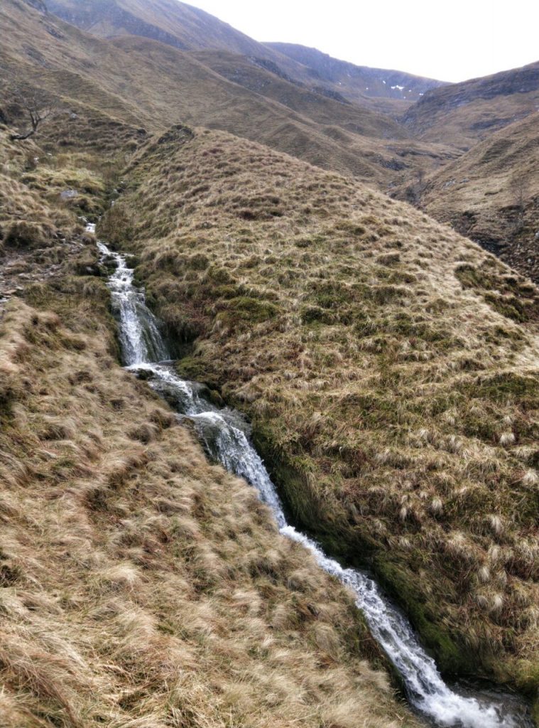
When I arrived at Hen Hole, there were a couple of people already there occupying the best piece of flat ground. I had a brief chat with them and pitched my tent near the waterfall as the sun was going down. It’s a magical place. Things were going well.
Day 1: Hen Hole to Byrness
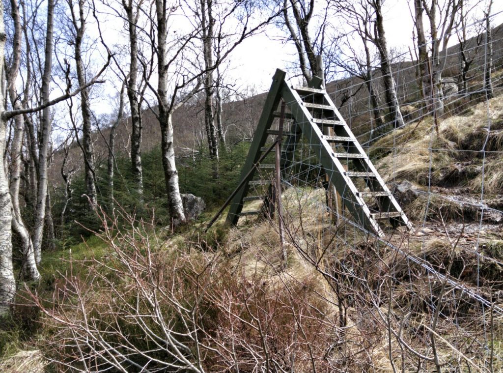
I knew that, after leaving Hen Hole, I would need to be carrying any water I needed. For this reason, I’d invested in a two-litre water bladder to supplement my large water bottle. This bladder can be rolled up to almost nothing when not being used, so I thought it would be ideal. Unfortunately, shortly after ascending the steep hill 500m from Hen Hole, it must have fallen out of my rucksack. I hadn’t secured it to anything.
This was a bit of a problem, as I couldn’t find it again. I only had two litres of water for a fair few hours of walking with a heavy pack (18.6kg). For some reason I thought that carrying more than the recommended limit of 20% of my (~90kg) bodyweight would be a good idea. It wasn’t, and it took its toll; I was dehydrated by the end of the day.
As I walked down into Byrness, I decided to ask my family to bring another rucksack to swap with the one on my carrying. I was aware this would mean sacrificing quite a bit of kit, but to be quite honest was a case of doing that, or giving up and going home. I decided to jettison things including:
- Z-Lite foam mat
- Spare clothes
- Additional gloves and hat
- Pennine Way guidebook
- Jungle blanket
I only just managed to get everything into my Montane 32-litre rucksack. Thankfully, I knew from experience that the ice-axe loops could hold my one-person tent. As the trip progressed, I learned how to pack it better, and the number of dehydrated meals I was carrying decreased. This all helped.
That evening, I took my parents out for dinner, as they had been the ones who had kindly driven over to swap my rucksacks. I spent the night in the camping pod I’d booked at Border Forest Holiday Park.
Day 2: Byrness to Stonehaugh
I’ve learned from experience that context is everything when it comes to walking: what’s the weather going to be like? how am I feeling? It’s for this reason that I don’t tend to book anything more than the first night. I think I’ve also read that every campsite on The Pennine Way will find room for solo walkers anyway.
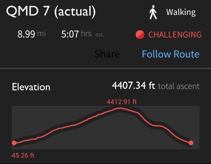
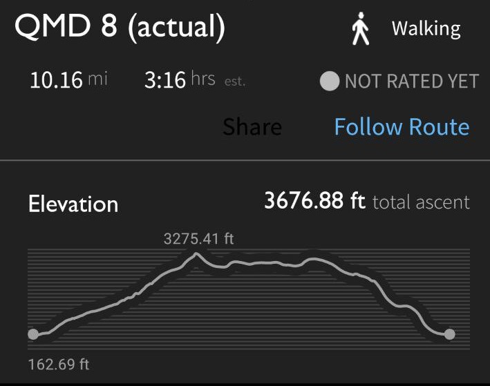
The average amount of time it takes to walk the trail is 17 days. Kirk Yetholm to Middleton-in-Teesdale is 125 miles, so you’d expect most people to take around eight days for this section. I had planned to take somewhere from six to seven days initially. However, on the morning before I left (Saturday), my daughter’s football match was postponed to Thursday evening. All of a sudden, I had something to aim for. Doing 125 miles in five days seemed… doable? I’d done the 84 miles of Hadrian’s Wall in 72 hours!
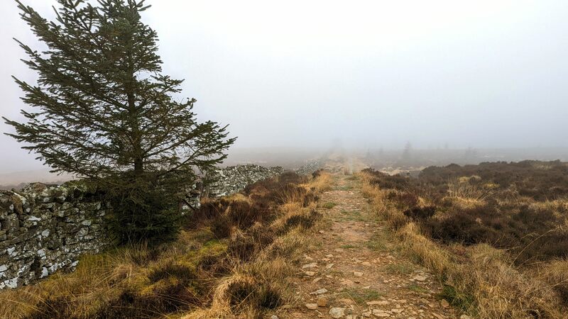
Walking from Byrness to Stonehaugh was pretty straightforward. The highlight, after walking through the mist and the heather was stopping off in Bellingham at the excellent Fountain Cottage. I had the all day vegetarian breakfast, followed by a sticky toffee pudding. They also let me recharge my phone.
I arrived at Stonehaugh campsite just before their reception closed at 20:00, bought a couple of things from their small shop, and paid for a pitch. I had the entire place to myself, and it was glorious.
Day 3: Stonehaugh to Alston
Confession time: I cut a corner on the way to Alston. The Pennine Way follows the route of Hadrian’s Wall, which is very up-and-downy. It then takes a right-angle and goes across some boggy land. I decided to have lunch in Haltwhistle, and then take the parallel River Tyne Trail. When I arrived at the hostel in Alston, the owner said that a lot of people do that, so I didn’t feel too bad.
On the way, I continued to listen to The Book of Trespass by Nick Hayes. I’d already read it in hardback as a birthday gift, but listening to the author reading his own work added emphasis to sections I’d perhaps only skim-read. It’s such a good book, and extremely related to some of the land I crossed. Highly recommended!
Alston has one of the best Spar shops I’ve come across. When I was growing up, I thought our local Spar was the only one in the world. Only when I started travelling outside of the UK did I realise they’re all over Europe! This one had a deli, and was licensed to sell game meat. It was deluxe.
My feet were fairly battered that night. I’d effectively walked a couple of marathons by that point, and was thankful that I had some Compeed with me. And some peanut M&Ms and beer.
I had a chat with a retired guy who was staying at the hostel. It’s interesting to me that there’s a whole generation of people for whom therapy would be beneficial, but instead they talk to random strangers about things extremely tangential to the general thrust of conversation. It’s all fairly benign, but he wasn’t the only one I’ve come across on my travels.
Day 4: Alston to Dufton
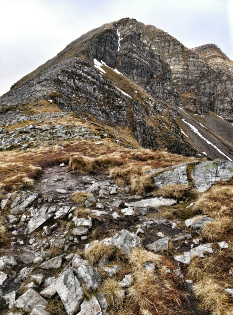
Everyone assumes, with good reason, that if you say you’re doing The Pennine Way, you’re doing it from south to north. So some people thought I was heading in the wrong direction when I set out the next morning. I cheerfully corrected them and they wished me luck: the route from Alston to Dufton goes over several 800m+ mountains.
I hadn’t slept that well, as my feet were ‘fizzing’ with pain. I laced up my boots tightly, which I’ve had for getting on for six years and which were falling apart a bit at this point. Having learned my lesson from the first day, I carried a bottle of Lucozade with me in addition to the water I was carrying.
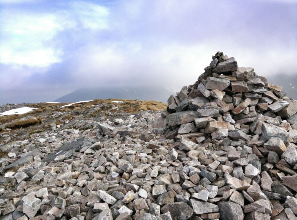
Unlike previous days, although the rain was predicted to still hold off, it was supposed to be windy. I was pleased, then, not to encounter much of it on the route up to Greg’s Hut, a well-known (and well-used!) bothy on the trail. I had a chat with a couple of people over lunch who were, inevitably, heading the opposite direction to me. They told me how awful the wind had been that morning.
The meta-conversation that accompanies the verbal conversation that walkers have on the trail is fascinating to me. Am I more experienced than this person? Is that gear brand new because they’re new to walking, or because they’re out all of the time and buy the latest kit? How quickly are they doing it? Part of it is posturing, but part of it is whether to give or ask for advice. Or maybe it’s just all in my head.
The wind was coming at me from my left-hand side at (what felt like) about 45mph all afternoon. So it really wasn’t fun walking up and across from Cross Fell to Great Dun Fell. As a result, I walked down the road instead of up Knock Fell, rejoining the trail further down.
By this point, I’d finished listening to The Book of Trespass and moved on to re-listening to The Old Ways by Robert Macfarlane. This had been gifted to me by a friend and I’d enjoyed it so much last time, I thought I’d give it another listen while walking. On the approach to Dufton, however, I was so tired I needed beats to keep me going, so switched to the album Starboy by The Weeknd.
I had dinner at The Stag Inn, followed by what can only be described as an attempt at sleep in a four-bed private room at the hostel. I’d only booked and paid for a single room, so the amount of space was pleasing. What was concerning was the state of my feet.
It’s difficult reading about other people’s pain, as what is an excruciating bodily experience for the sufferer cannot adequately be represented using mere words. On returning from the pub and shuffling to and from the shower, I had to keep my feet elevated. I couldn’t even stand hanging them over the side of the bed as the weight of them just hurt.
By the time it got to midnight, I had a decision to make. It wasn’t whether to go home or not, because that could wait until the morning. I’d run out of ibuprofen, and only had tablets which were a combination of paracetemol, aspirin, and caffeine. Did I want pain relief or sleep? I decided to take the tablets, and continued reading A Walk in the Woods by Bill Bryson on an old Kindle.
I also listened to some music on the iPod I’d modded with this trip in mind. It didn’t let me down, and putting the album Ambient 23 by Moby on repeat finally lulled me off to sleep.
Day 5: Dufton to Middleton-in-Teesdale
I’d booked breakfast for 07:30 but, as it was slightly late in arriving, I got talking to a couple of people. The conversation started by me casually asking whether they had any ibuprofen, given there isn’t a chemist in the village. They hadn’t.
The thing that was keeping me going at this stage was knowing that, if I just kept putting one foot in front of the other, I’d make it to Middleton-in-Teesdale by the end of the day. Then, I could be whisked away to watch my daughter’s final football match of the season.
I bandaged my feet, packed my bag, tied my walking boots extra-tight, put my game face on, and walked out into a 25mph wind blowing against me. There was no point even attempting to listen to anything. It was a grumpy walk.
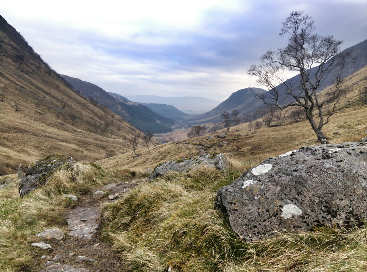
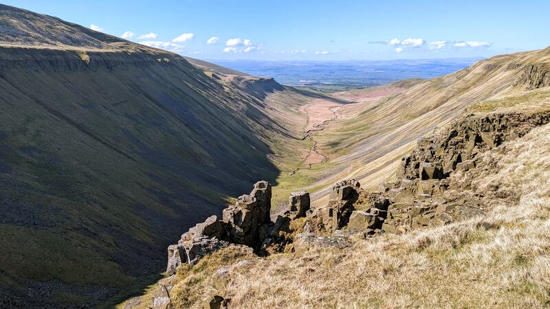
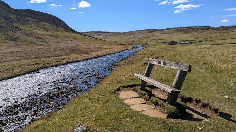
There are several spectacular things that you walk past on the route from Dufton to Middleton-in-Teesdale (or vice versa). High Cup Nick is “almost a geometrically perfect U-shaped chasm”, Cauldron Snout is the longest waterfall in England, and High Force is an impressively loud, touristy, waterfall. Sadly, with feet that felt like stumps, walking into an incessant wind in a hurry to get somewhere, I didn’t really have the time or patience to fully engage with them.
At times, I framed the wind as my enemy, daring it to “do its best” as I scrambled over boulders next to the River Tees. To top it all off, for the first time since the start of my trip, I went hours without any mobile phone signal. I’d been posting to my Mastodon account, and the replies, boosts, and favourites had kept me going — along with messages from family and friends.
At around 14:00, I found half a bar of signal and messaged my long-suffering parents to ask if they were still OK to pick me up. They were, and had been waiting for confirmation. I’d like to take a moment to thank them (as I know they’ll read this) for supporting me even as a 42 year-old through my self-inflicted trials and tribulations.
Despite literally following a GPS dot on the Ordnance Survey maps on my phone, I was so tired that I managed to take a wrong turn. Once I realised my mistake, it took almost an hour to rectify. I realised that I wasn’t going to make it to the pick-up location for the agreed time. The wind had died down a bit, so it was time for a blast of Kylie’s latest album to cheer me up, followed by Exit Planet Dust, the Chemical Brothers album that was the soundtrack to the second half of my teenage years.
I met my parents just north of Middleton-in-Teesdale near Wynch Bridge, the world’s second-ever chain-link suspension bridge (1741). Happy to have finished, I asked them to drive down to Middleton-in-Teesdale to the chip shop. I messaged my wife. She told me the game was off as the other team had forfeited.
We drove home. What an anti-climax.
Conclusion
There are many ways I could conclude this post. I could finish on a positive note, expressing pleasure that I challenged myself and was up to it. I could be sheepish about not-quite-exactly staying on the trail. I could express frustration at the match being called off. I could note that I seem to turn everything into a performance, and what does that say about me? I could talk about my gear and how I immediately got rid of my boots and bought some new ones (along with a new rucksack).
But doing something like walking The Pennine Way isn’t one thing, it’s many things. I didn’t think any particularly deep philosophical thoughts while on the trail. What I did do was exist outside of the bubble of work and family that define 99% of who I am and what I do on a day-to-day basis. And knowing who I am without the doing is something I need to practice.
So I’m looking forward to my next trip. I’ll probably try and drag our 16 year-old son out for an overnight in Hen Hole once he’s finished his GCSEs. I noticed his ears prick up when I mentioned the prospect of a pub. And I’ll probably do a car camp with my daughter in the summer.
But my main focus is on the second leg of this Pennine Way walk. Right now, if the stars align, it’s looking like I might be able to walk it during the third week of August. A summer walk will be different: the weather, the number of people on the trail, etc. But then, just as Heraclitus said about rivers, every walk is the same, but different.