
Quality Mountain Days 7 & 8: Ben Nevis, Stob Bàn, and Mullach nan Coirean
I’m aiming to get on a Mountain Leader course by 2018. To do so I need to complete (and log) twenty ‘Quality Mountain Days‘. The last time I was out was a couple of weeks ago in The Trossachs, which you can read about here.
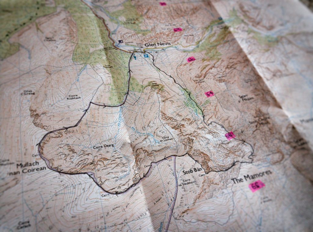
I planned my routes last weekend. Ben Nevis was straightforward to plan(up and down the tourist trail as fast as I could), but Stob Bàn, and Mullach nan Coirean looked like it would be more interesting.
On Monday, one of my clients sent me a link to this BBC News article about a new feature of the Ordnance Survey app. It looked incredible, and I already use the mobile app, so I signed up for a premium subscription. This gives me access for a year to a whole range of features, one of which is the new 3D functionality in the web version.
All of a sudden, those contour lines came to life:
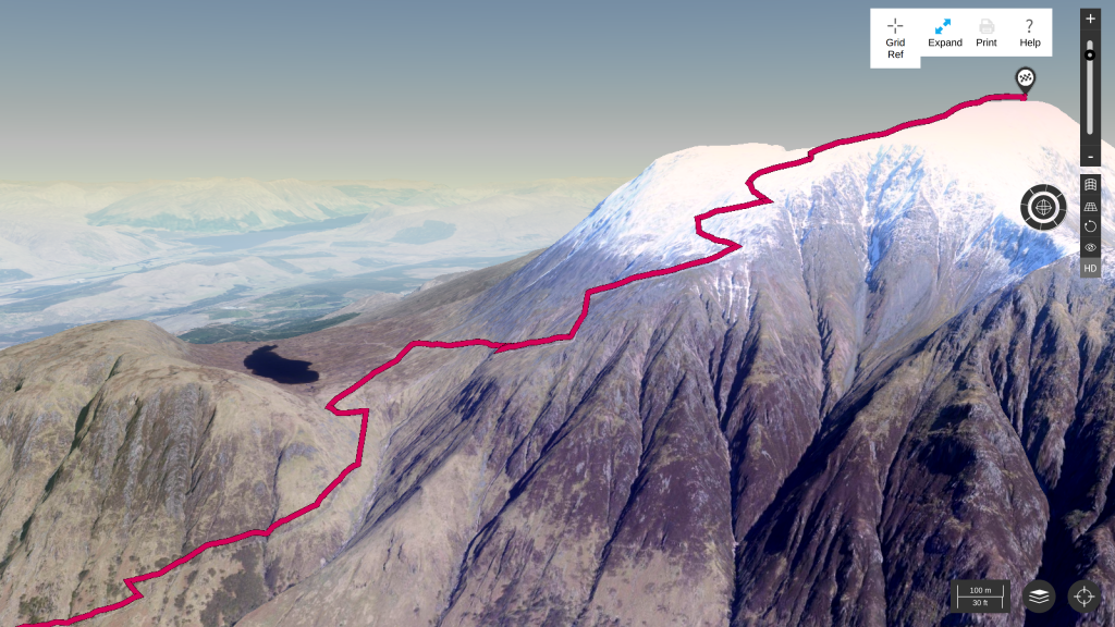
There was a brief discussion on Twitter (including official Ordnance Survey account) as to whether such easy access to 3D visualisations was a good thing. Some argued that it might lead to less emphasis being placed on the ability to read contour lines.
My view is that it helps enormously with planning, as it allowed me to decide where would be good places to stop and eat, as well as the parts of the route which would require more effort.
Friday (QMD 7)
I got up at 04:45, had breakfast, did some final packing and checking (including of the mountain weather service) and set off. I was on the road by 05:30 and it took almost five hours to reach Fort William, the town at the base of Ben Nevis. I left a route card with the guy who runs the hostel I was booked in at, and drove to the Ben Nevis visitor centre car park.
After I got changed and paid my car parking, I set off straight away. The Ordnance Survey app reckoned it would take me 4.5 hours to ascend Ben Nevis, and I reckoned on a descent of about two thirds of that time. So, about 7.5 hours was the time I allotted.
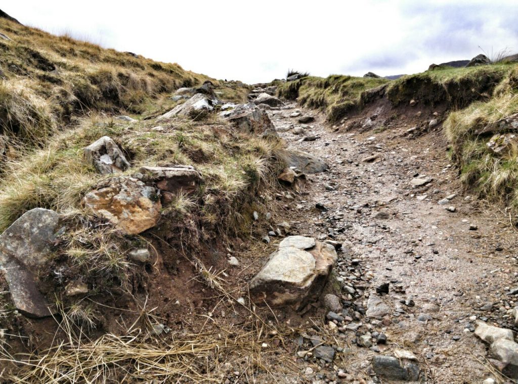
In the event, it was a lot easier going that I expected. The first part of the route, up to the waterfall, is almost a motorway. The next part was steeper, but not particularly a problem. The only bit that was a bit tricky was the snow and ice above 900 metres. It made me wish I had walking poles — and it was almost slippy enough for crampons.
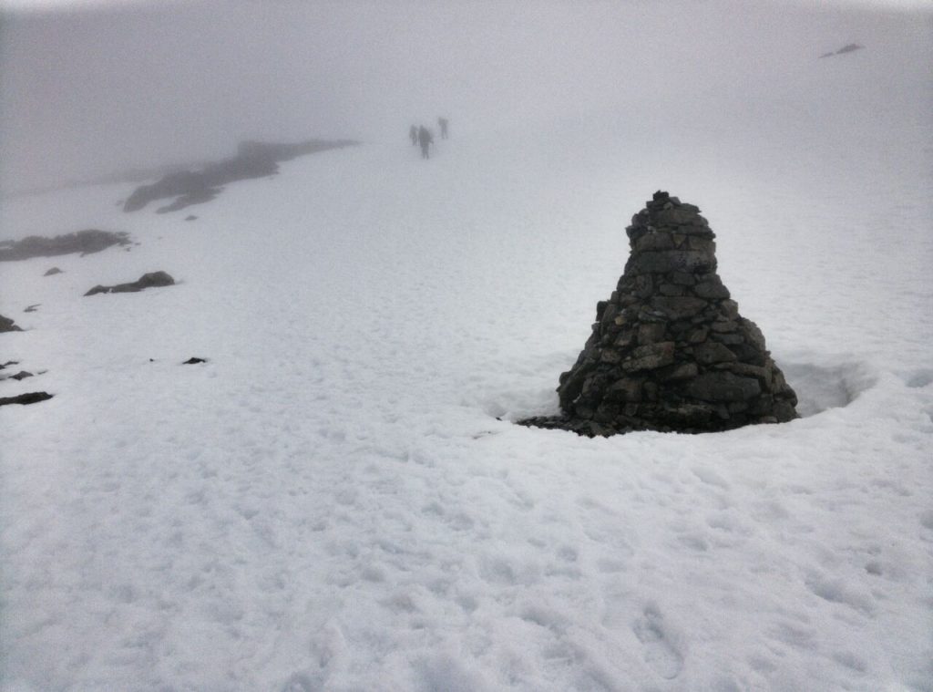
Walking through the cloud layer was interesting, as I had to go from waypoint to waypoint, as well as following walkers in front of me. I can see why in low visibility it can be easy to get disorientated. At the top, I checked out the highest war memorial in Britain, and then headed back down.
Although walking uphill can be tough stamina-wise, I prefer it to walking downhill, which is hard on the knees. I skidded a few times coming down the snow and ice, but after that it was long and boring, but easy-going down to the bottom.
I won’t be hurrying back to do Ben Nevis again but, if I do, it will be with someone else, and we’ll stay at the Ben Nevis Inn & Bunkhouse. It doesn’t look anything special on the outside, but I went there for dinner after a shower at my hostel and checking Foursquare. The food was good, it’s cozy, perfectly placed at the start of the route to the top.
In the evening, I had a great conversation with a thatcher who had come up on the sleeper from London with his mountain bike, and an Australian who was on a tour of Europe. I also got to start an excellent book by Richard Sennett entitled Together : the rituals, pleasures and politics of cooperation, while listening to a record player in front of an open fire.
Things I learned
- Just because a route is popular doesn’t make it interesting.
- Circular routes are the best.
- Walking poles aren’t just for old people.
Saturday (QMD 8)
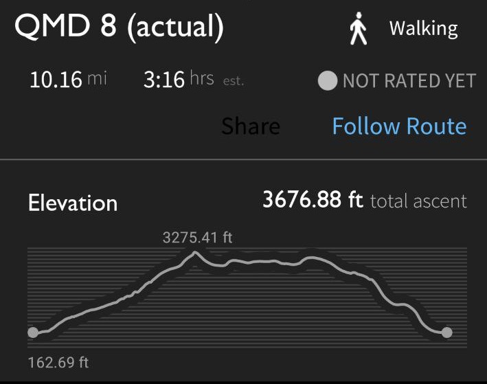
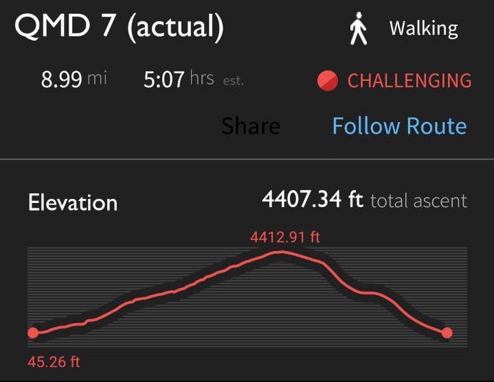
(N.B. the timing on this is incorrect, but the distance and elevation seem correct)
I was in a mixed dormitory at the hostel. That was fine, but makes changing clothes, etc. something you have to think about rather than just get on with. Of the six of us, the two middle-aged guys snored like troopers, and one of the women talked in her sleep. But, hey, I don’t go to hostels for a good night’s sleep.
Getting up at 05:45, I knew that I had to get out quickly if I wanted to complete my route and then drive back home the same day. I got ready, had some breakfast, handed my key in, and drove to the start point, a car park in Glen Nevis. I reckoned that my walk would take around seven hours, and started at 07:45.
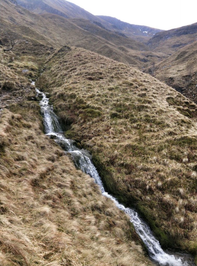
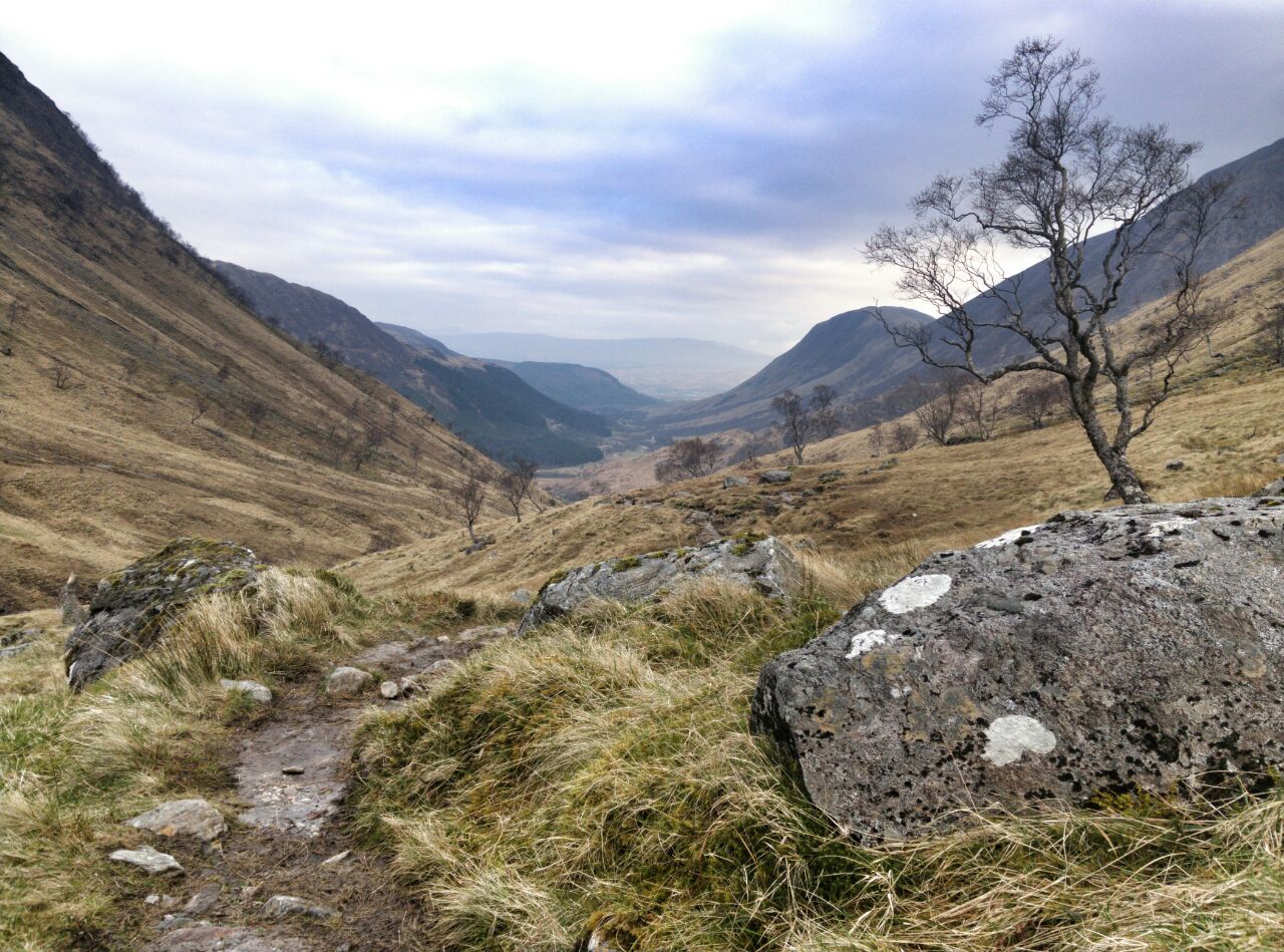
The path up Stob Bàn was really interesting as it wound alongside a river with plenty of stream flowing into it.
The day before, I’d passed lots of people going up and down Ben Nevis, and even walked with one guy for a while. However, on Saturday I saw no-one for six hours. And yes, it was bliss.
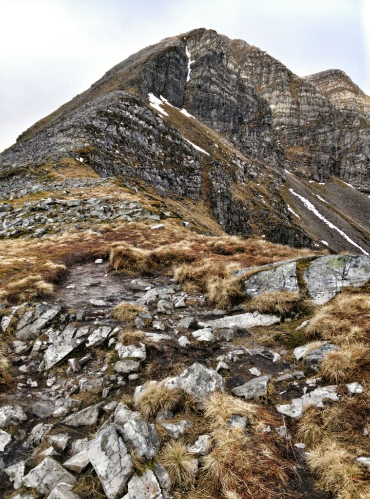
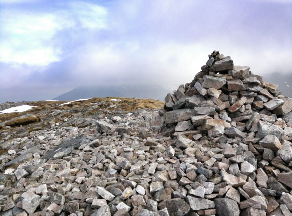
As I approached Stob Bàn, the wind picked up and the ascent looked more formidable than I had expected. In the end, however, it wasn’t as difficult as it looked, and the views were amazing. I pushed on to Mullach nan Coirean.
Having visualised this route in 3D, as well as my route up Ben Nevis, I’d noticed that there was a different way down than the one I’d planned. Unhelpfully, this left me in two minds while I was going over rocky ground. I ended up veering off-course, and ending up in a situation where I had to do a course-correction. Instead of retracing my steps or climbing up another steep ascent, I decided to make my way down the mountainside.
This was tough going, and I skidded a bit down the wet heather. I eventually made it to the bottom of the valley, only to find that the fence I was looking for as a waypoint on the map actually impeded my progress. Noticing that someone had cut a small hole in the wire fence, I squeezed through like an octopus.
Walking along the fence on the other side, I then came across this:
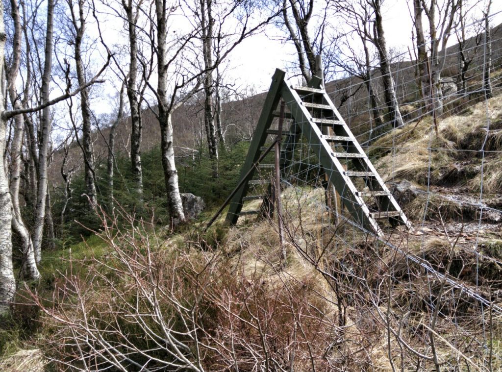
Needless to say, it wasn’t marked on the map. Nor, though, was the path down from it to the track, so I half-walked, half-ran down back to the car. I stripped off, rubbed myself all over with a wet flannel, changed my clothes, and started the journey home.
Apart from a quick stop in Stirling for an emergency milkshake and to go to the toilet, I made it back in one go. Sitting down for 4.5 hours after walking for six isn’t the best idea in the world, but today I’m not as stiff as I was last time.
Things I learned
- A thick sweatband would be a good addition to my gear.
- Check and double-check your route when stopping for a drink/snack.
- Five hours each way is perhaps too far to drive each way for a two-day trip!
We are going up tomorrow, and thank you for your insights.
Have fun!