Open Thinkering

Menu

Tag: Mountain Leader

Quality Mountain Days 19 & 20: Sharp Edge and Hayeswater Gill

Note: This completes the twenty Quality Mountain Days (QMDs) required to book myself on a a Mountain Leader course!


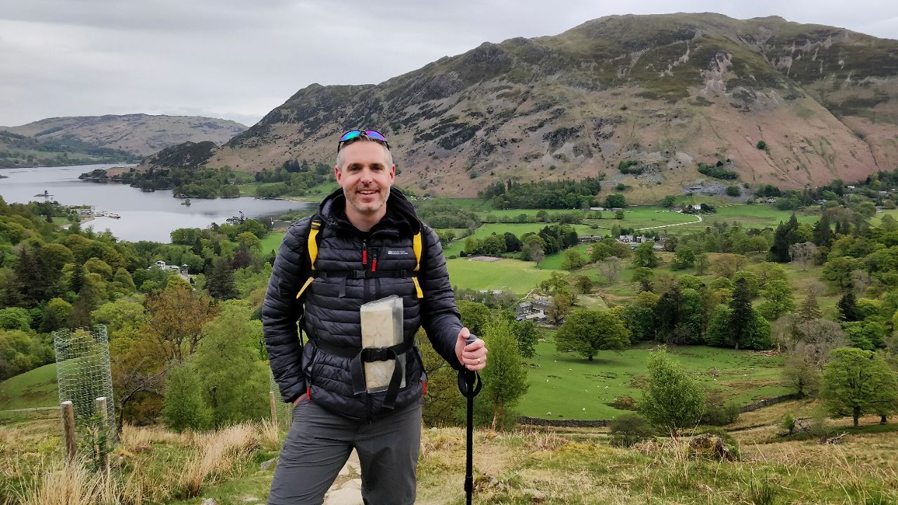
This weekend, I’ve once again been over to the Lake District to get in a couple of walks. There were two differences this time around, other than walking up mountains I haven’t attempted before:

  1. My ribs still weren’t right from the previous weekend at Scout camp and I’m still on a cocktail of painkillers.
  2. I was accompanied by Tom Broughton, who I picked up at Penrith train station.

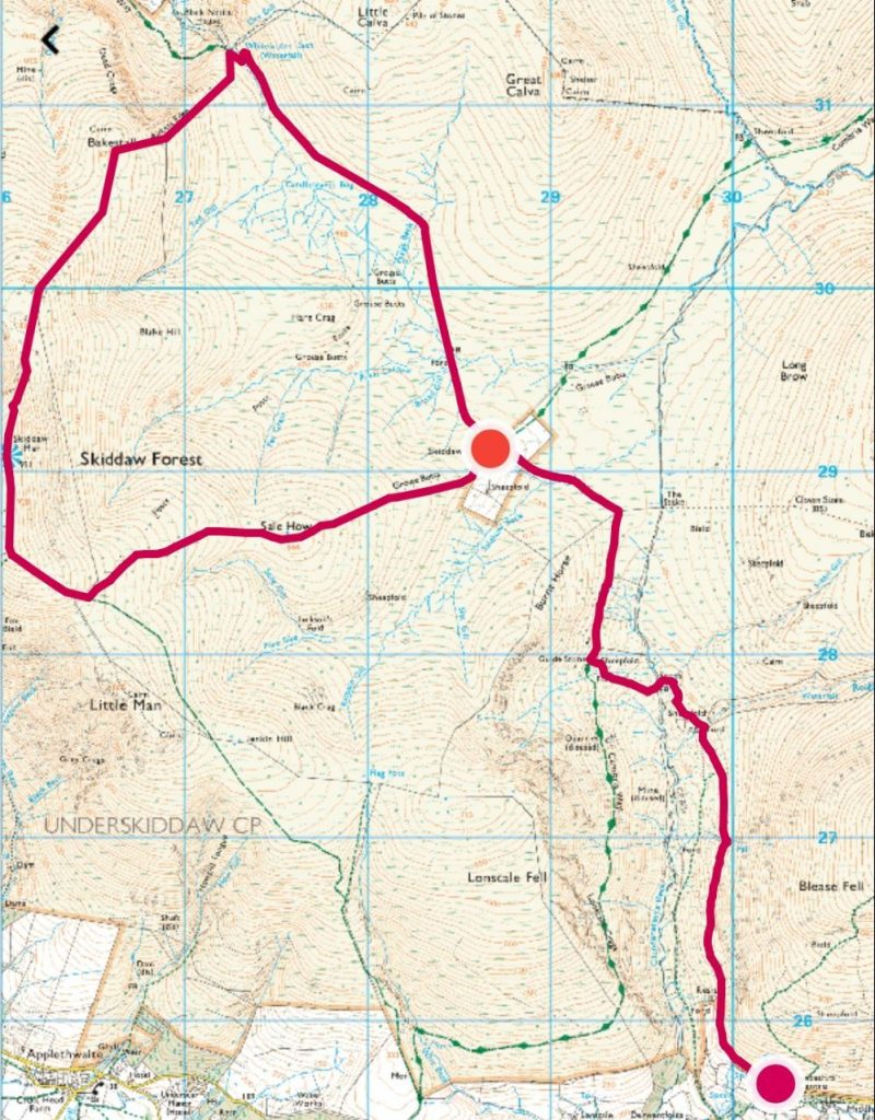
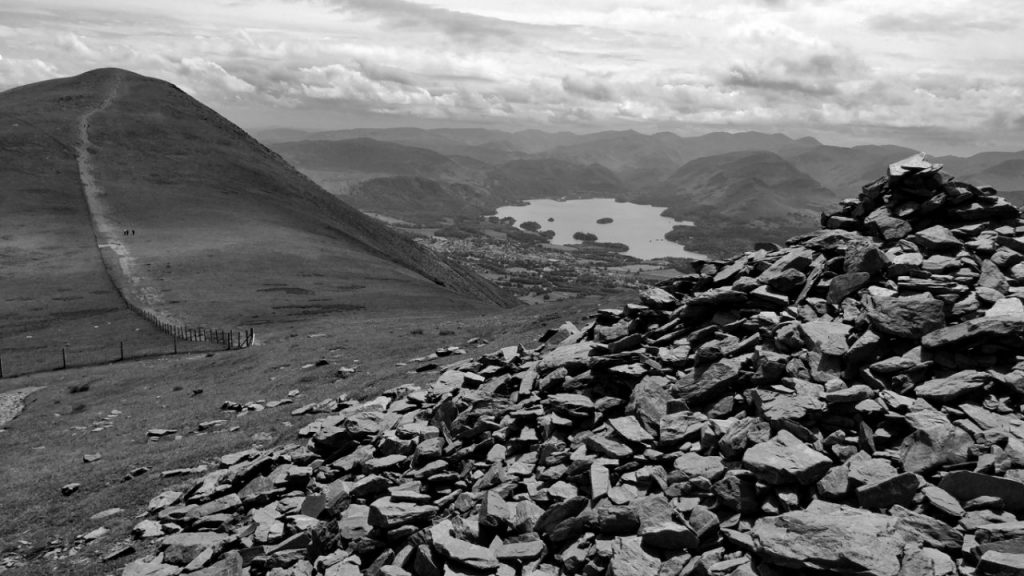
QMD 19: Sharp Edge, Blencathra, and Bowscale Fell

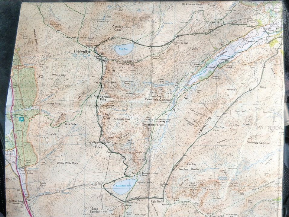
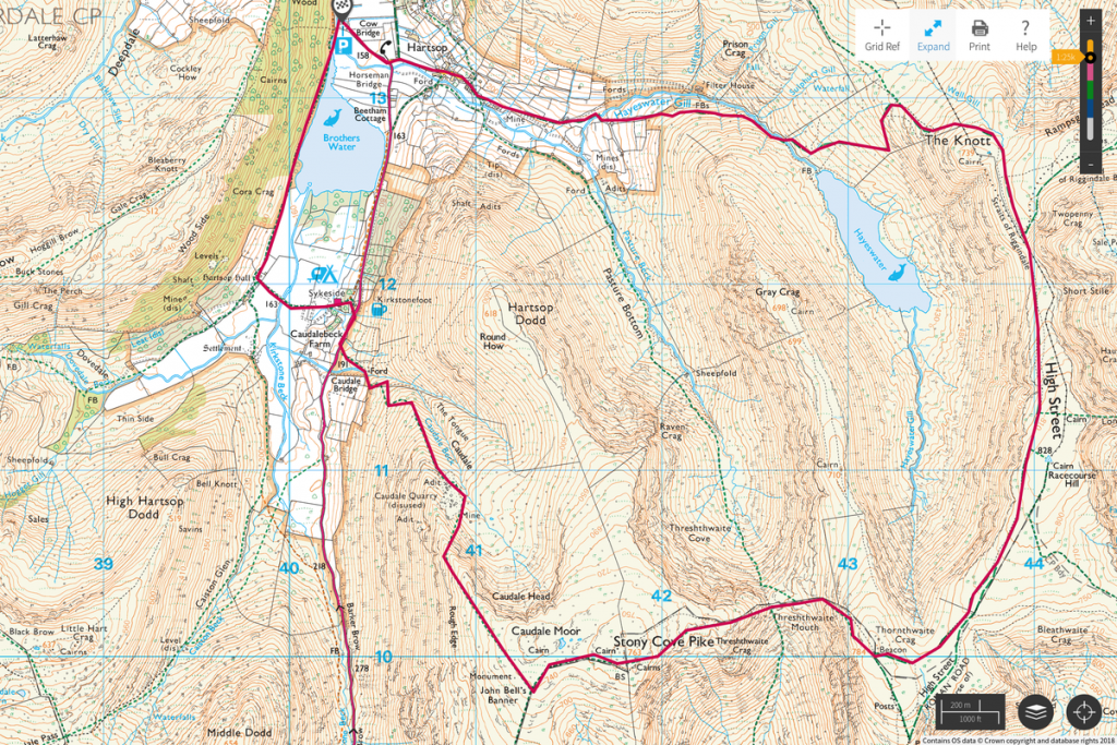
Tom was kind enough to send through some suggested routes from a book he had. I adapted one of these to create this route for our walk on Saturday (QMD 19):

QMD 19 (planned)
QMD 19 (planned)

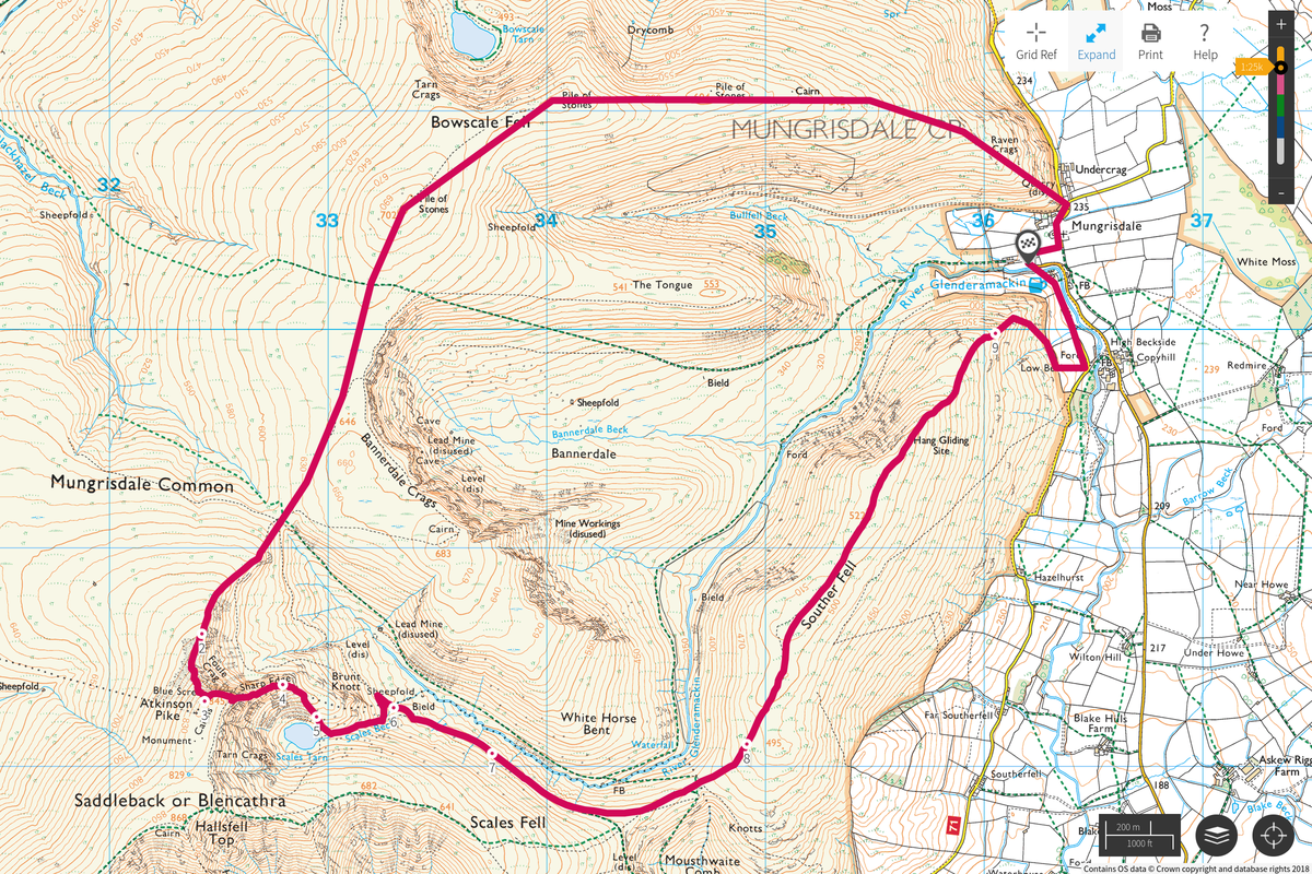
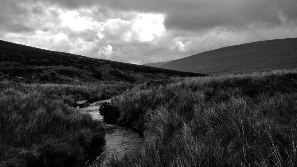
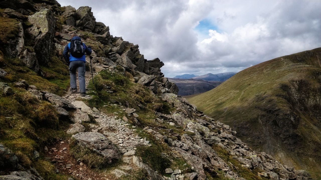
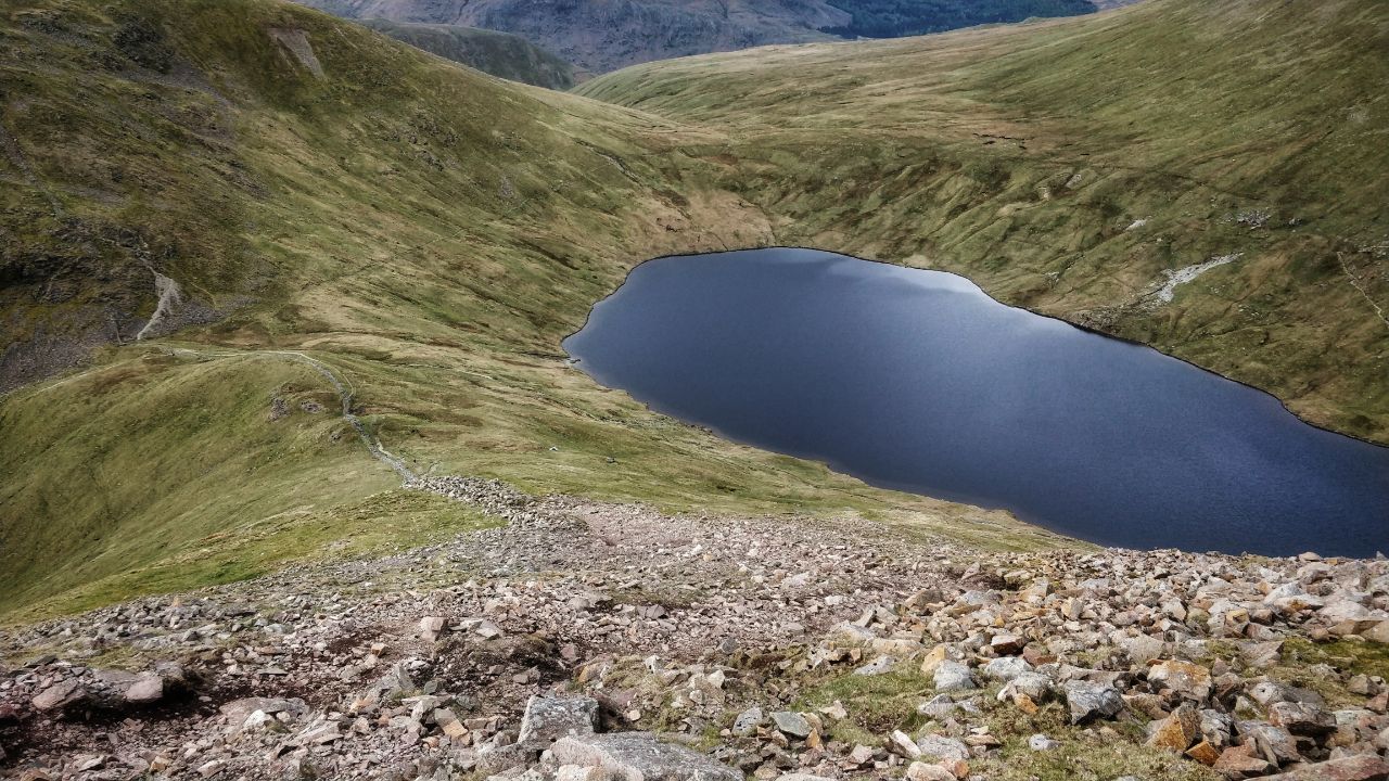
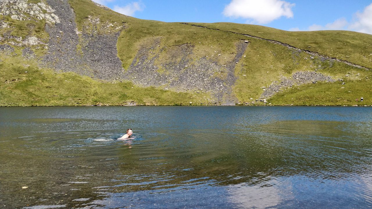
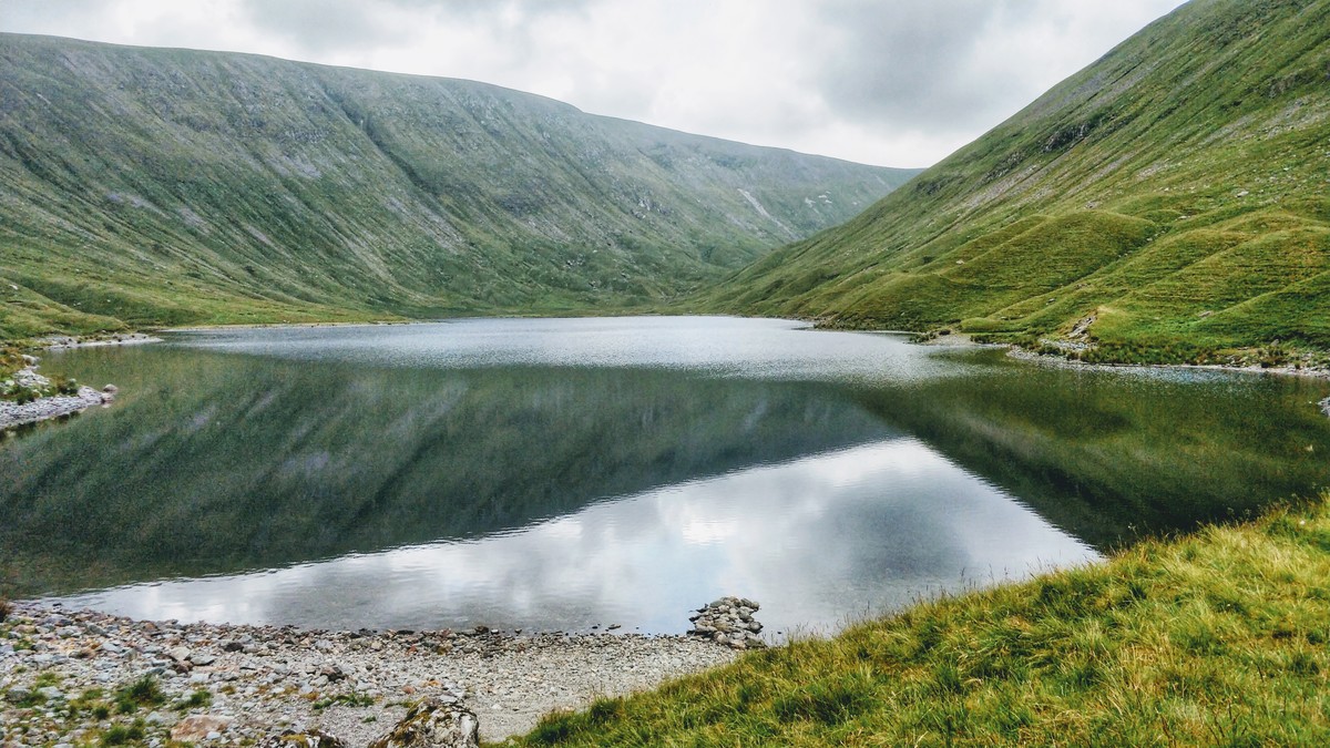
We left the car near Mungrisdale, and walked clockwise up Souther Fell, and then up to Scales Tarn. Tom fancied a dip, so he stripped down to his underwear and dived in!

Tom swimming in Scales Tarn

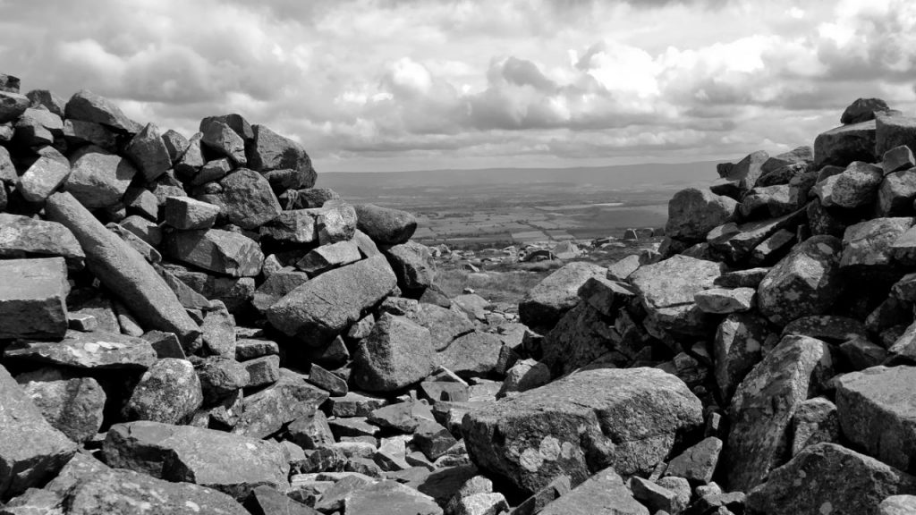
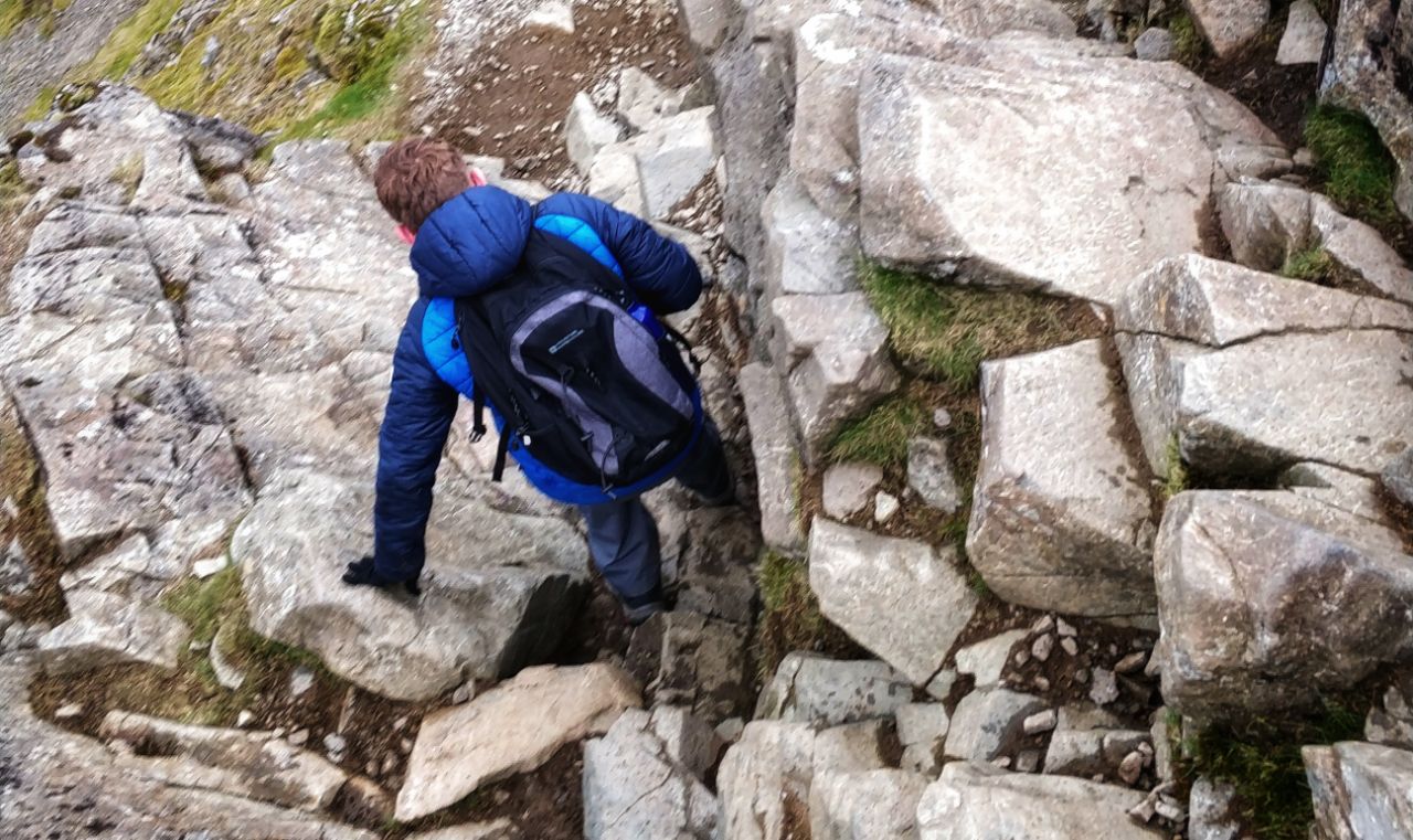
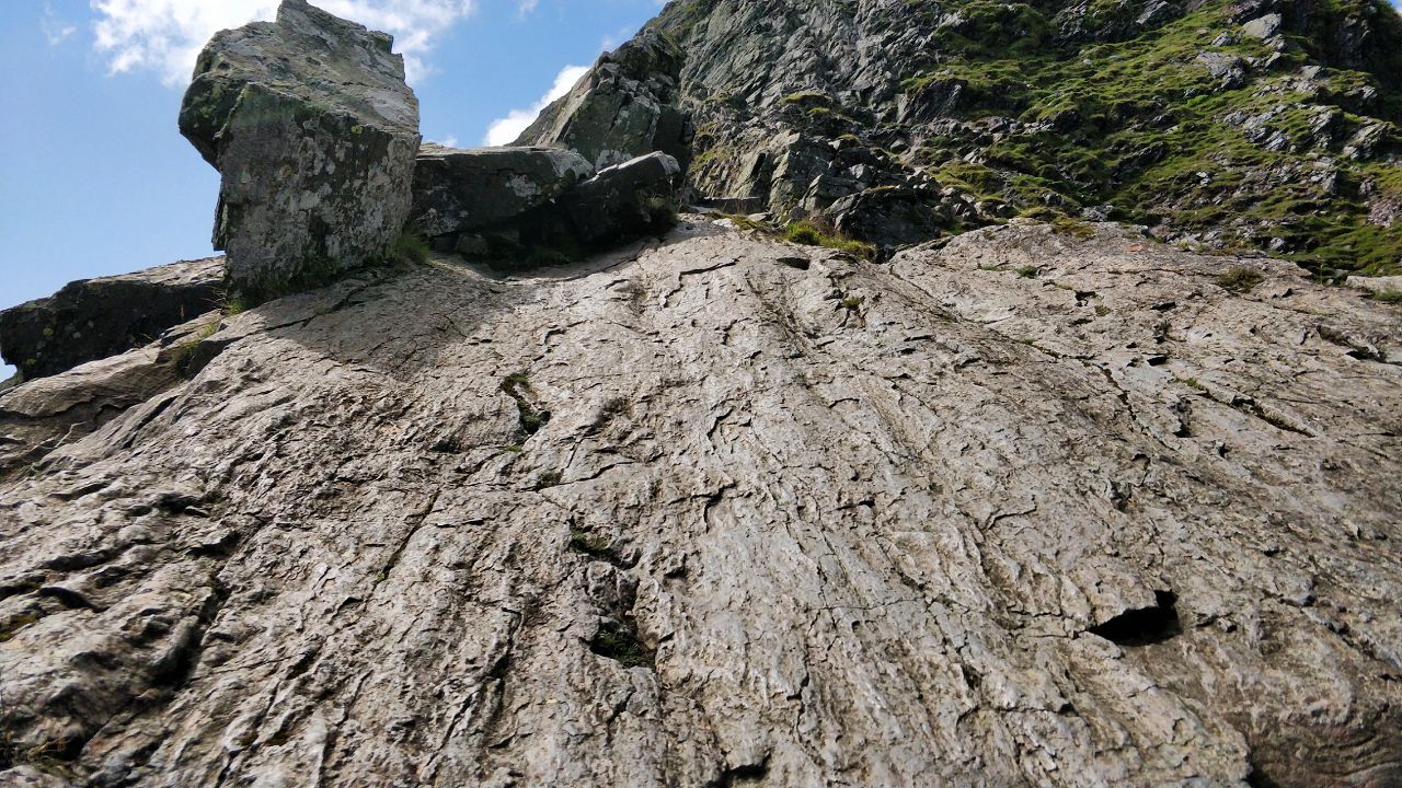
After lunch, we walked up the path you can see behind the tarn, up Sharp Edge. Tom enjoys scrambling, and I appreciated the challenge! We made it up though, and in a slight deviation from the original plan, then headed over to Blencathra.

Scrambling up Sharp Edge

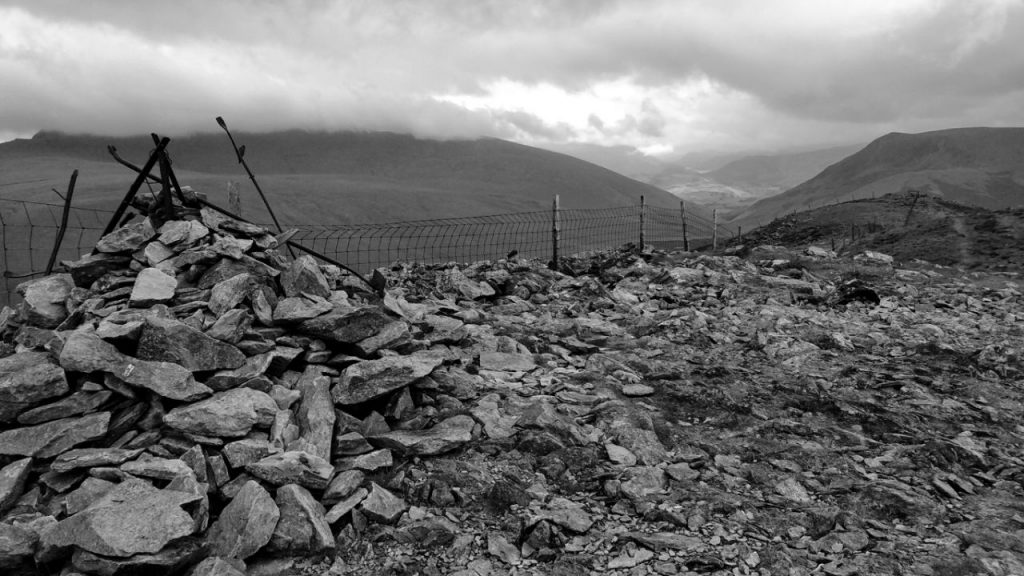
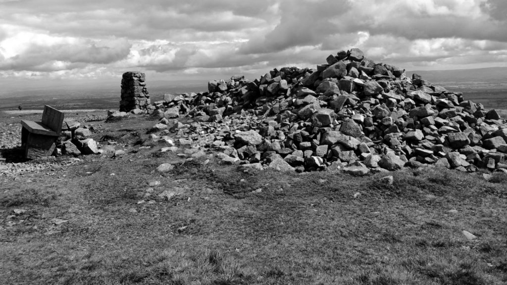
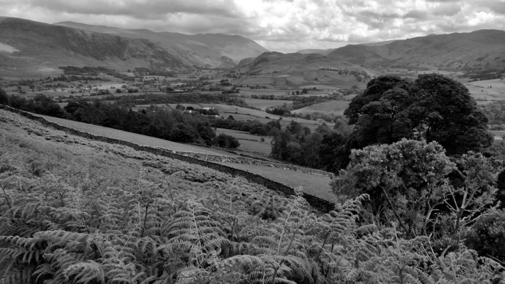
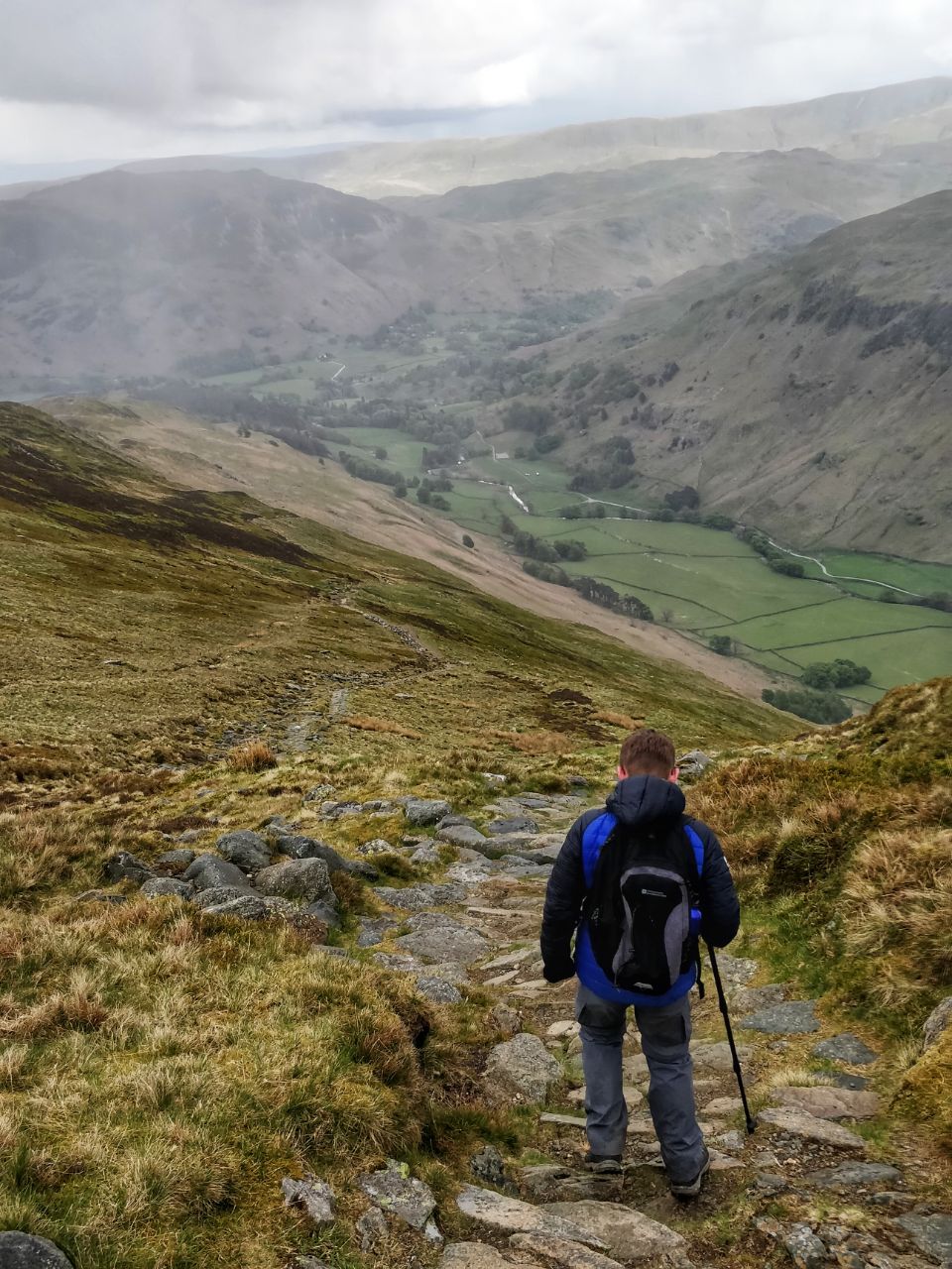
It was a pretty straightforward walk from Blencathra over to Bowscale Fell, and then down back to the pub and then to the car.

Foxglove near the end of our steep descent down from Bowscale Fell

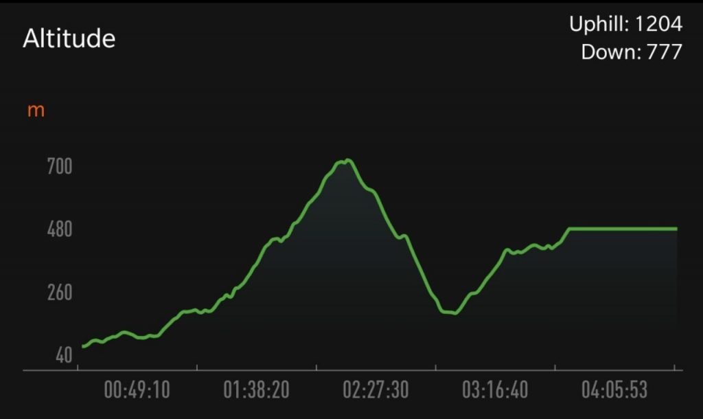
The main challenges on this walk were our health. I was struggling a little with my ribs, and Tom hadn’t done much since injuring his knee last year. Although it turned out to be a walk of about six hours, but one which we were just pleased to complete!

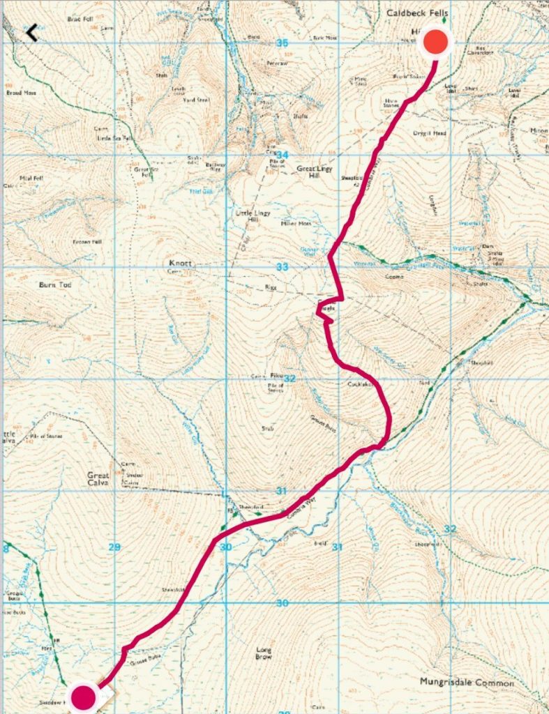
QMD 20: Hayeswater Gill, The Knott, and High Street

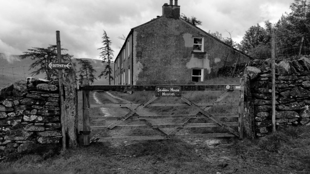
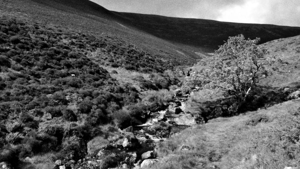
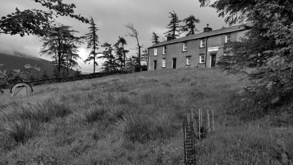
At YHA Patterdale on Saturday night, Tom and I planned out our route for the next day. He was keen to do some scrambling, and we identified a particular one up a waterfall just up from Hartsop that looked interesting.

QMD 20 (planned)

From there, we planned to go up The Knott, and then down High Street and around to Stony Cove Pike.

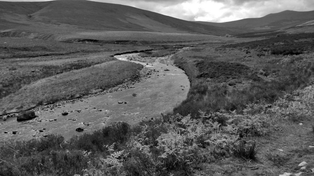
Given Tom had a booked train to catch, we gave ourselves the option of going down Pasture Bottom instead. In the end, because we spent a good deal of time going up Hayeswater Gill, that’s exactly what we did.

Relaxing in a waterfall pool after scrambling up Hayeswater Gill

The scramble up Hayeswater Gill was challenging in places, and I slipped over once onto my knees, and saw my sunglasses float away down a narrow channel. Thankfully, Tom managed to retrieve them, and it was mainly my pride that was hurt.

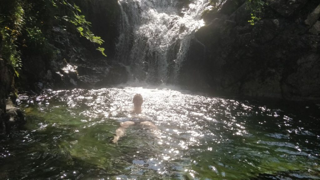
Tom convinced me to have a dip in a pool created by a waterfall near the top of Hayeswater Gill. The water was freezing, but the experience nevertheless glorious.

Hayeswater
Hayeswater

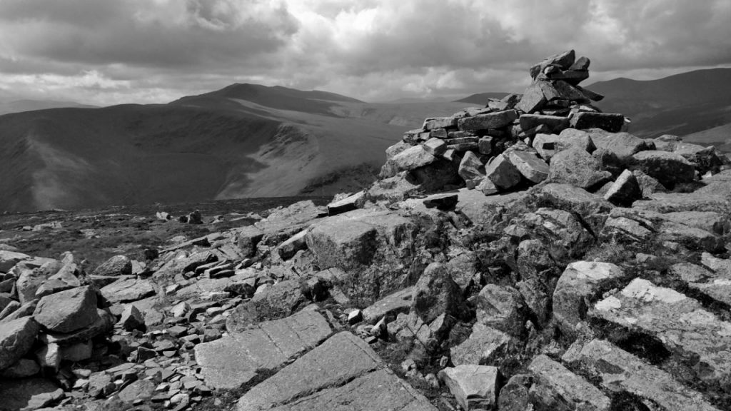
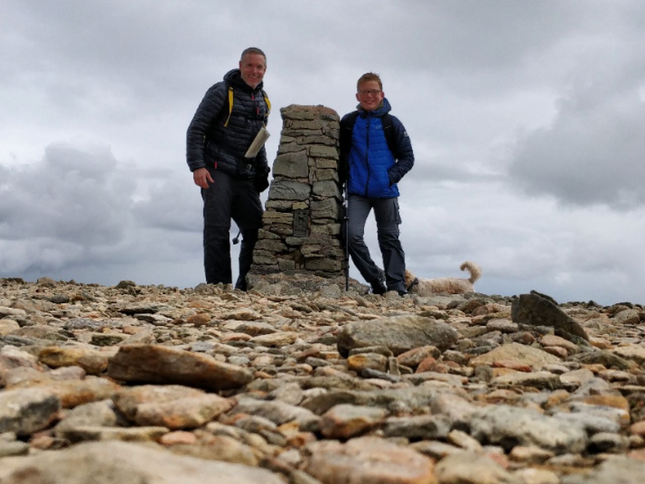
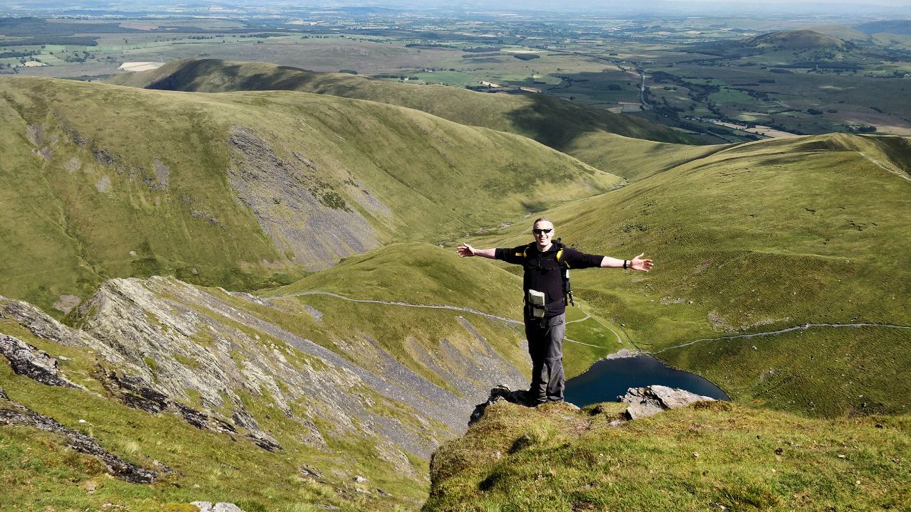
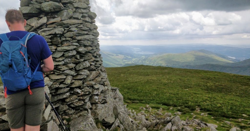
The ascent up from Hayeswater up The Knott was pretty steep, but worth it when we got to the top. We then walked across to Thornthwaite Crag where there is a beacon.

Tom at the top of Thornthwaite Crag

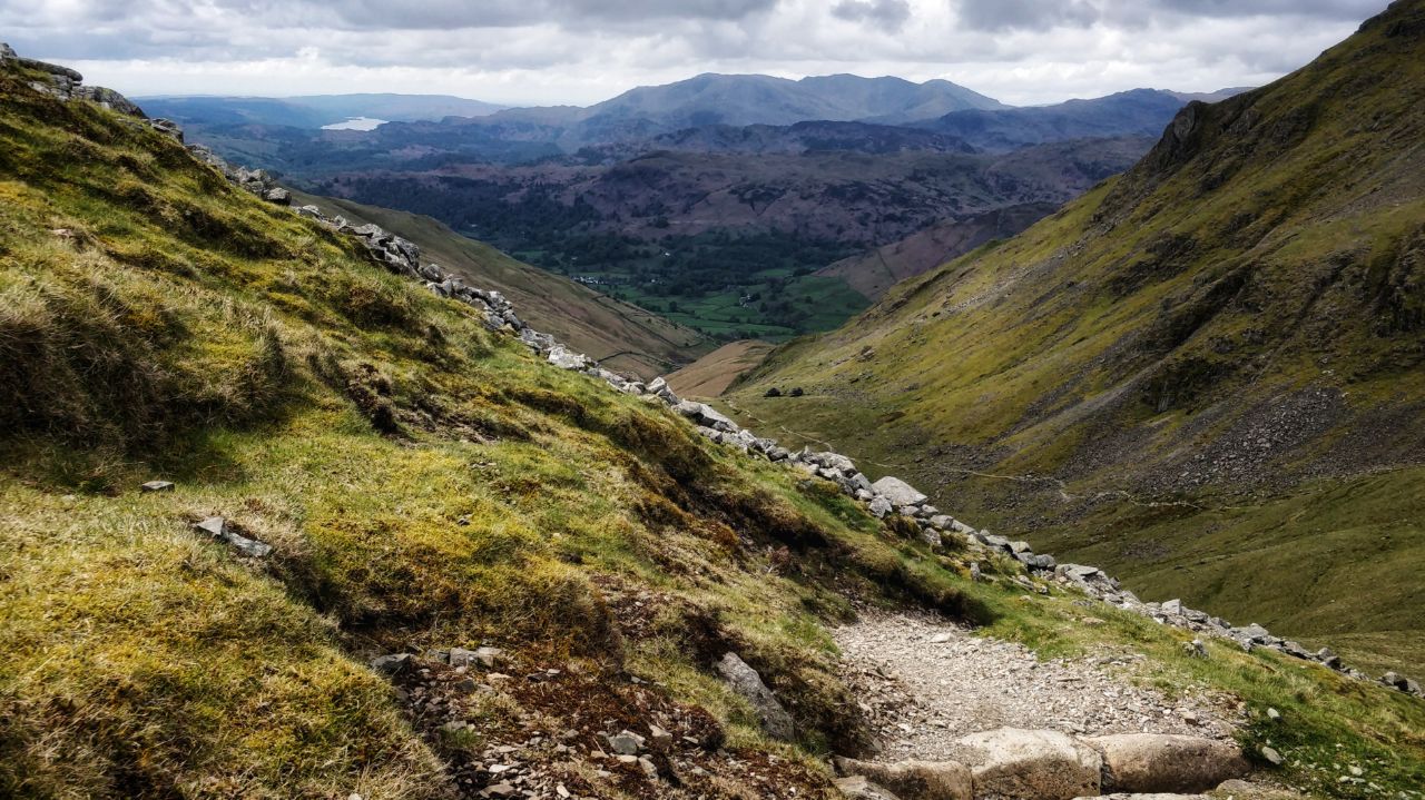
We stopped for something to eat, but there were lots of midges about, so we ate quickly and started the steep descent towards Pasture Bottom.

The walk along the river and back to the car was a little bit boggy, but relatively unproblematic. Tom and I talked about life, the world, and… co-ops, actually.

When we got back to the car, I stripped off and had a quick rinse in the river before getting changed. We found a pub, sunk a pint, and headed to Penrith to drop Tom in time for his train. I’d definitely go for a walk with him again, as he was good company, and challenged me to do stuff I wouldn’t have otherwise done!

Next steps

The Mountain Training website lists a number of organisations that run Mountain Leader courses. It’s a six-day course, and it looks like I’ve got a couple of options:

  • All in one go: take a week off work and do six days in one go in a single location
  • Split weekends: do three weekends spread over a few months, in three different locations

The second option is most appealing to me, but can’t make any of the options this year. So it looks like potentially May 2020.

In the meantime, I’ll probably get in some bonus QMDs just in case, and sign up for the Mountain Training Candidate Management System so I can officially log all of the walks I’ve recorded on my blog!

Quality Mountain Days 17 & 18: Skiddaw, Great Calva, High Pike, and Carrock Fell

Note: I’m near to completing the twenty Quality Mountain Days (QMDs) required to book myself on a a Mountain Leader course.


I’m sitting writing this in our garden in the blazing sunshine. In front of me, my tent, which I only put up again to dry out about 10 minutes ago, is ready to be put away.

A day only counts as a QMD if you do something that takes you out of your comfort zone a bit. So, if you go up the same mountain by the same route a couple of times, it only counts as one QMD. This time, I thought I’d throw some camping into the mix.

I haven’t been camping by myself before, ever. To ease myself in gently, I thought I’d camp outside a hostel, although to add a bit of spice I thought I’d make it Skiddaw House, the highest hostel in Britain.

As a result, I had to carry my tent, sleeping bag, and other equipment I’d need for an overnight stay, to the hostel. I planned my routes accordingly:

QMD 17

On the first day, I’d planned to walk up from the public car park next to the Blencathra Field Centre, leave my large rucksack, and then do a circular route around Helvellyn while carrying my smaller rucksack. On the second, I planned to walk to High Pike, come back to Skiddaw House and pack up my tent, and then head back down to the car.

Setting off towards Skiddaw House

Neither went as planned, for a couple of reasons. Firstly, unlike Santa Claus, when I make a list I have a habit of forgetting to check it twice. As a result, I didn’t take my gaiters or walking poles. Second, the routes I’d planned weren’t really long enough.

View from near the top of Skiddaw

As a result, on the first day, after ascending Sale How and Skiddaw, I amended my route to also head up Little Calva and Great Calva. After a very steep ascent up Dry Gill, a few spots of rain turned into a downpour and, despite putting on my waterproofs, I got absolutely soaking. Trudging down through the heather back to Skiddaw House wasn’t an enjoyable experience.

The rain coming in as I ascended Great Calva

Although I tracked my route using my smartwatch, I kept forgetting to press ‘continue’ after any short rests or breaks. As a result, I’ve only got the first four hours of data for the QMD 17, but I was definitely out for over five hours in total!

Altitude over the first four hours of QMD 17

That night, after pitching my tent on wet ground in the rain, I went inside and spent a very enjoyable evening making dinner, conversing with those staying in the hostel itself, and drinking whisky.

Skiddaw House

When I reluctantly headed out to my tent, it rained until midnight, but according to my stats, I did manage to get some deep sleep in before waking at 05:30.

QMD 18

The next morning, I went into the hostel for breakfast and to get changed. Given how wet my tent was, I left it up to dry out as best it could, made some lunch, and started striding out towards High Pike.

Heading out for QMD 18

My boots gave me some problems on this trip. They’re about 12 years old, and so had many pairs of insoles. Unfortunately, while the most recent gel insoles I’d purchases are comfortable, the bottom of them have lost all stickiness, meaning they roll around my boot. I kept having to stop to sort them out and, indeed, I’ve got a few blisters.

Walking along a river

Towards the end of last year, I gave up drinking coffee as part of my daily routine. I discovered that it was correlated with me getting migraines. What I had found, however, was that Lucozade, coffee, and other caffeine-based stimulants, seemed fine when I was doing any kind of exercise (like walking).

High Pike

Unfortunately, that wasn’t the case this time around. After dragging myself up High Pike, I decided to head towards Carrock Fell, as we’d talked about the remnants of an Iron Age hill fort there the previous evening. It was extremely windy. I was struggling a bit. A fell runner nonchalantly ran past me.

Carrock Fell

I kept on plugging away when the tell-tale signs of migraine started to appear; that little coloured shimmer that appears in the corner of your eye and starts working its way over. I took one of my Rizatriptan tablets and drank plenty of water. I made it to the top of Carrock Fell, and flopped into a little circular shelter made of stones.

Sheltering at the top of Carrock Fell

By this point, I knew that this was going to be a longer walk than I’d planned, so I tried to shave some time off by traversing the side of Carrock Fell and making my way down to the path. In my migrainey state, I tripped and fell a couple of times, but only into the bracken and long grass.

Walking back to Skiddaw House

Once I made my way to the path back to Skiddaw House, I once again took off my boots, sorted out the insoles, and removed my waterproofs. The 5km from there back to the hostel was entirely on autopilot. I felt like a broken man.

Back at Skiddaw House

Back at the hostel (finally!) I sat down for a minute, then set to work packing up the tent. It was still a bit wet, and I didn’t have the energy to take it down properly, so I stuffed it in its bag, and packed everything inside the larger rucksack that I’d left inside the hostel.

Almost back to the car

The walk down from the hostel to the car was another 5km, but this time with my large rucksack on my back. It felt like double that. I would have collapsed at the boot of my car, to be honest, had there not been a group of schoolchildren listening to their teacher pontificating.

Conclusion

As I’ve mentioned before, every time I go on a walk I have a music track that ends up playing on repeat in my head. This isn’t something I choose, it’s just something that happens. Quite appropriately, this time around it was Got To Keep On by The Chemical Brothers. The lyrics are simple but were oh-so-appropriate:

Gotta keep on, gotta keep on

[…]

And the rain comes down
Like tears, like tears
And the rain comes down
Like tears, like tears

There are many things I learned about myself and about spending time in the mountains during this trip. These include:

  • Camping isn’t such a big deal when you’re staying next to a hostel
  • Double-check equipment lists before leaving
  • Don’t drink coffee, even when doing exercise

I’ve only got a couple of QMDs left to do now, and I plan to do at least one of them with one other person. Although yesterday in particular was hard-going, I’m really glad I did it, and can definitely see why this is a requirement of getting on the Mountain Leader course!

Quality Mountain Day 16: Fairfield, Dollywaggon Pike & Helvellyn

As you’ll know if you’re a regular reader of this blog, I’m on course to complete twenty Quality Mountain Days (QMDs) sometime this decade, so that I can book myself on a a Mountain Leader course. On this occasion, and for the first time, I took our 12 year-old son Ben with me to the Lake District.

By way of context, inspired by the film School of Rock, our family has a saying that we trot out, usually with a wink or a glint in our eye: “You’re not hardcore, unless you live hardcore.” It’s our way of encouraging one another. What Ben completed today was impressive for a boy of his age. I didn’t take him over Striding Edge, despite his pleas, because people die on there and, well, that’s for another trip (not his first!)


Planned circular route starting near Patterdale

A few days earlier we had planned our 17km route together using map OS4 and a HB pencil. I also booked us into Ambleside YHA, which is one of my favourites in the Lake District. As it was Bank Holiday weekend, the prices were all over the place, and it turned out to be cheaper for us to get a 3-person private room that for both of us to stay in men’s dorms. Crazy.

Ambleside is beautiful

Before going, we transferred the route we’d drawn out on paper onto the OS Maps app on my phone, and then logged into my account on a computer to view the fly-through. The initial ascent looked quite steep and, indeed, it proved to be just that. At one point I thought it was raining, but it was just the sweat dripping from my head!

That hill was STEEP
That hill was STEEP

Thankfully, it was an almost-perfect day for walking. Not too cold, not too sunny, and virtually no wind. We did had the world’s most gentle hail at one point, which was almost laughable.

Climbing up Grisedale Pike

Further on, I remember looking up at Grisedale Pike after coming down Fairfield and saying to Ben that it looked like entering Mordor. He smiled and, a few steps later, I realised that he’s never watched The Lord of the Rings films. Note to self: fix that Dad fail right away!

Tarn at the bottom of Dollywaggon Pike

At about this point, Ben was tempted by a shortcut, but I convinced him to stick to our plan. After sliding on the scree down Grisedale Pike and Ben falling over three times (yes, I counted), we decided to walk around the right-hand side of the tarn instead of the left. This was mainly because we wanted to go across the stepping-stones, next to which we stopped and had a snack there.

The view going up Dollywaggon Pike

The way up Dollywaggon Pike was perhaps the most arduous section of the walk. It was at this point I taught Ben about what to do if one of us got hurt, how to use the whistle to make short blasts, when to use his mobile phone, and how to keep injured person warm. I’m not sure how much went in, as we were trying to ensure a bald guy with a dog didn’t overtake us. (Ben’s quite competitive, a trait he must have inherited from his mother…)

Ben and me at the top of Helvellyn with random dog in background (courtesy of the timer on my smartphone, hence the angle!)

Once we got up Dollywaggon Pike, the walk across to High Crag and Nethermost Pike was easy. We avoided the mountain biker coming down Helvellyn, and had lunch at the top. It was a bit smelly as I think someone into the joys of public urination had marked their territory. We also got talking to some people who delighted in telling us that part of the route that Ben was proud to be achieving had been completed by their sons when they were five. Some people just make you 🙄

Coming down from Helvellyn via Swirral Edge

As I’ve already mentioned, we had already decided not to do Striding Edge this time around, and instead came down Swirral Edge. This seemed like particularly hard work, which makes sense after reading this article on the ten most dangerous British mountains:

[T]he most dangerous part of the mountain [Helvellyn] is actually the short descent onto the start of Swirral Edge which, particularly in winter conditions, can be lethally slippery.

After seeing no-one for the first part of our walk, this section was a lot busier. I noticed that a lot of people didn’t seem very prepared for a mountain walk, wearing pretty flimsy trainers. No wonder they were going so slowly!

Walking back down to the car

The route back was pretty straightforward, although I did find it hilarious the number of times Ben adjusted his estimates of when we would get back. Now, fair enough, we did get back earlier than I thought we would, but his first guess was way off. The optimism of youth!

In the end, after tracking it on my GPS-enabled watch, it took us 5 hours 37 minutes to walk 17.58km. To his credit, Ben didn’t slow me down at all — in fact, I had to ask him to wait for me a couple of times! I’ll be taking him again.

Things I learned:

  1. Despite our preparations, we forgot gaiters, towels, and hayfever tablets. We didn’t need the gaiters, thankfully, and I managed to hire towels and buy the tablets.
  2. There was no place to park where I’d planned, which added a bit extra onto the walk (which we actually reclaimed via the shortcut around the tarn).
  3. We wasted 30 minutes driving back, as I went the wrong way. There was no signal and I’m used to using Google Maps. I should think and plan more about that.
css.php